No Surrender! Timor-Leste's La Rende!
Given the fact Timor-Leste is one of Australia’s closest neighbours, given the intertwining of our histories, and given the trekking there is so fantastic, it’s time that this fabulous destination was on more adventurers’ radars.
Words and Photography: Jayne D’Arcy
(This story originally featured in Wild #198, Summer 2025)
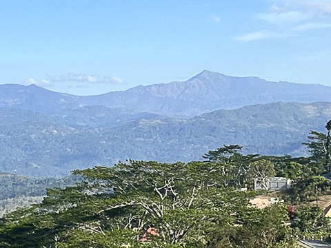
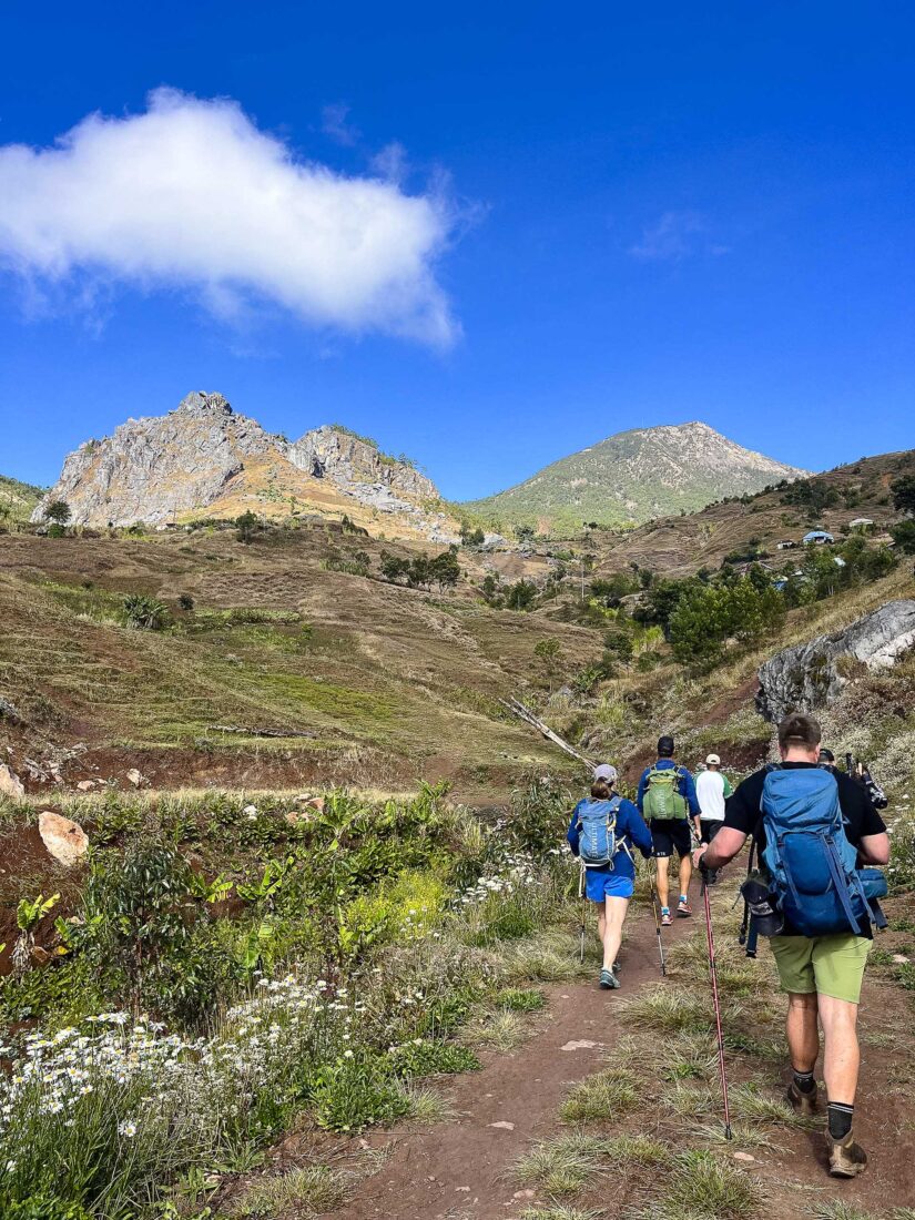
Life-changing. It’s too often said and written. But while I’m putting one gaiter-covered leg in front of the other, and striding comfortably with fancy carbon hiking poles, something in me switches on. The narrow singletrack trails we’re hiking have dry-season grasses bending over them, and there are protruding rocks in random places, so my eyes are busy flicking up from where I am to where I’m going. I try, as often as I can, to look up, because I can’t believe what I’m seeing. At one point, I round a bend and the view of sharp mountains in the distance comes into focus. I do a double-take: I could be in the European Alps. I came here expecting heat and unforgiving terrain: Instead, I find amazement.
This is Timor-Leste (half the island of Timor; the other half is Indonesian West Timor), a country known for its recent independence, its coffee and its iridescent reefs (it’s part of the Coral Triangle, whose waters are believed to be the most biodiverse on the planet). It’s also known for its oil and gas fields. What Timor-Leste is not known for is the mountainous spine running along its interior. Nor is it known for the quality of its trekking: Its trails take you walking through coffee plantations, wading through rivers, and navigating along the island’s raised backbone into fragile rainforest and down to waterfalls.
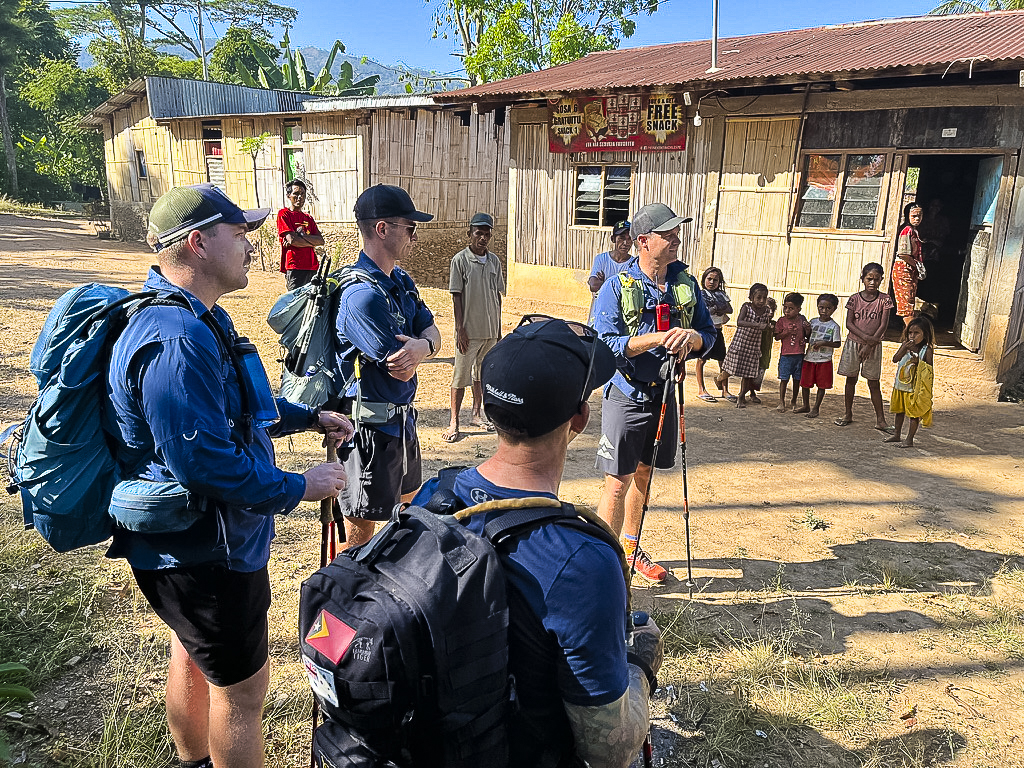
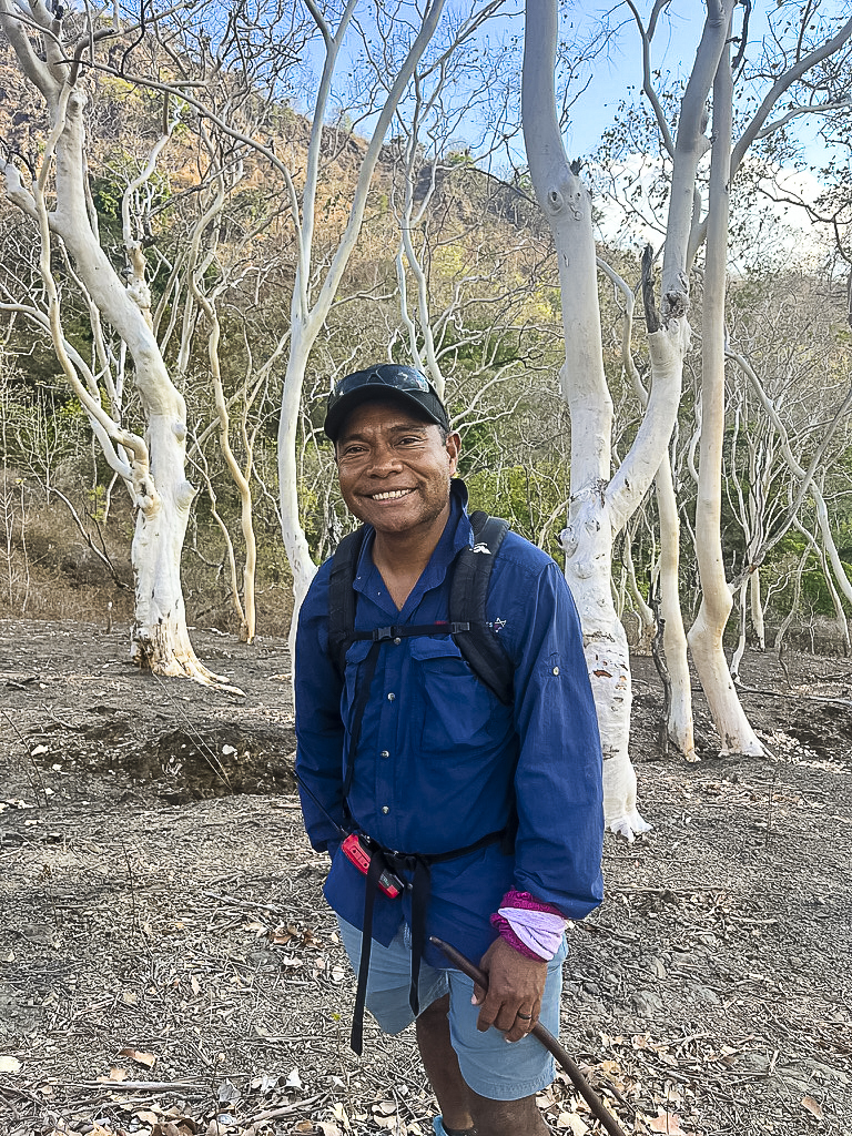
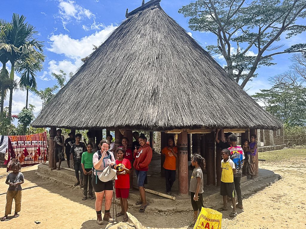
But it should be. I’m one in a group of eight hikers on the seven-day La Rende! Trek, Timor-Leste’s own spectacular version of the legendary Kokoda Track. (‘La Rende!’ means ‘No Surrender!’ in the local Tetum language.) The walk—which links up historical military sites with points of natural beauty like the Dokomali waterfall and the country’s highest peak, Tatamailau (Mt Ramelau)—is organised by Maddog Adventures, a young adventure-tour company that, although owned by Aussies Liesel and Sam Maddock, has a goal of promoting economic development in Timor-Leste’s rural communities. The company is already looking ahead beyond the young nation’s oil and gas revenues, because when that era ends, other income streams like tourism will become important. It’s what’s led Liesel and Sam to commence upskilling locals so they can manage, operate, and guide the trek, locals like guide Ollie Rangel, who is with us on the hike. And from each village along the route, locals are arranged to accompany trekkers and to share their stories and knowledge.
Timor-Leste is a country with a long colonial past. Think hundreds of years of occupation by the Portuguese, then a brief period of independence in 1975, followed by the 1975-1999 occupation by Indonesia. Timorese resistance fighters and their supporters hid in these mountains, running an ultimately successful resistance effort against them. Australians did the same in WWII, finding vantage points from which to spy, and plan attacks, on the Japanese. No wonder this interior has a sense of intrigue to it. Few know—me included—about the Japanese occupation and Australian WWII effort here; learning about this history is partially why I’m on this hike.
Timor-Leste was a strategic spot in WWII—with its easy access route to Australia (it’s an hour’s flight from Darwin)—and our hike takes us in the footsteps of the Australian commandos of the 2/2 (pronounced ‘second second’) who arrived here to (unsuccessfully) stave off the Japanese over eighty years ago.
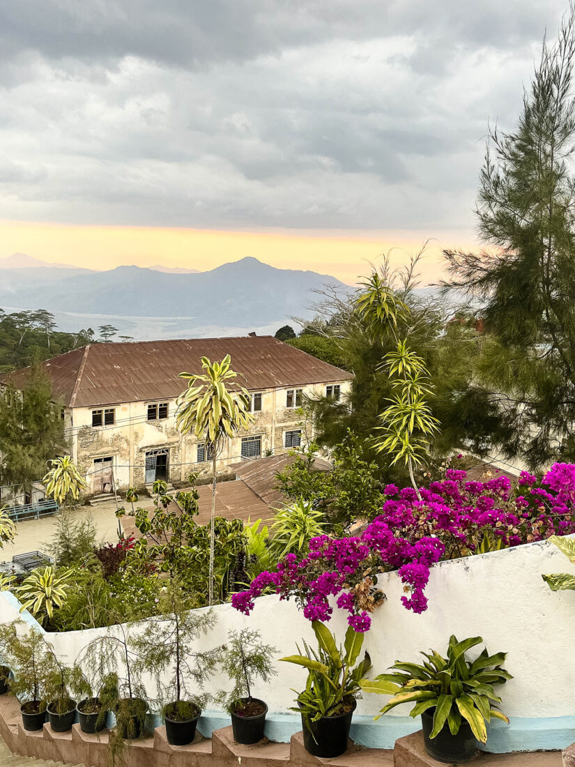
We begin with acclimatisation time in Dili. We stay at the Hotel Timor—one of the grander and central hotels in town. When its doormen swing open the glass doors for me, it’s like stepping into a colonial world, with carved wood, aircon, and a cafe serving Portuguese tarts and espresso. Soon our accommodation will be a combination of tents and family-run guesthouses that may/may not even have electricity for fans. Some contrast.
We’re mini-bussed high up the mountain behind Dili to the Dare Memorial Museum which commemorates the Australian commandos and Timorese kriadu (youth who willingly assisted the Australian soldiers). We watch a video with a voiceover from Kirsty Sword Gusmão, the Australian-born former First Lady of Timor-Leste, talking about the impact Australia had on the country in 1942. It’s not glowing: After the Australians left, tens of thousands of Timorese, including current President José Ramos-Horta’s family members, were killed by the Japanese for assisting them.
The next day, our group heads out under the hot sun on a ‘Battlefields of Dili’ walking tour. Guy Warnock, a historian and former Australian peacekeeping soldier who served in Timor-Leste, tells us the story of the 1942 landing of the small force of 300 Australian commandos with their Dutch allies. The 2/2 were fresh from training at Victoria’s Wilsons Promontory—today itself a prime hiking destination—and had arrived from neighbouring Dutch Timor ready to protect (neutral) Portuguese Timor’s airfield from the Japanese. Much of today’s Dili is built on an airstrip Australian commandos had tried to defend—and ultimately blew up—all those years ago. It’s such an interesting walking tour, but the sun is already unbearable, and I’m wondering how I’ll hike through it day after day.
But it’s soon time. A 4WD convoy brings us to the one-kiosk village of Asumanu, having stopped already near bigger Bazartete to explore the scene of a WWII battle. There, Guy took us into the bush and showed us some remaining Australian-dug gun pits and the original gravesite of two Australians killed there (their bodies were repatriated).
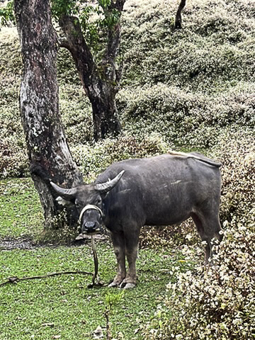
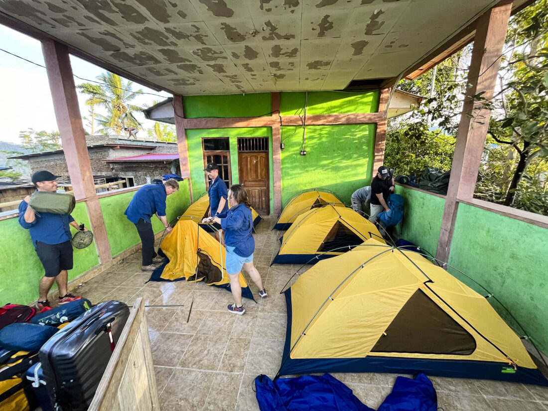
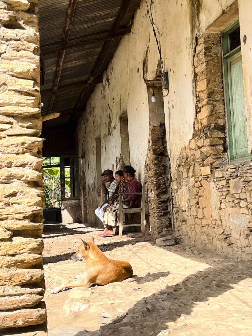
On the night before the trek commences, I’m getting school camp vibes as we blow up our mattresses and chuck them inside our tents. We’re sleeping in a tiled, sheltered patio of a small central building in the village, and locals are going about their usual business around us: drying coffee on tarps, heading out to feed goats. The older women chat and chew betel nut, smiling when we catch their gaze. The kids and local dogs are curious.
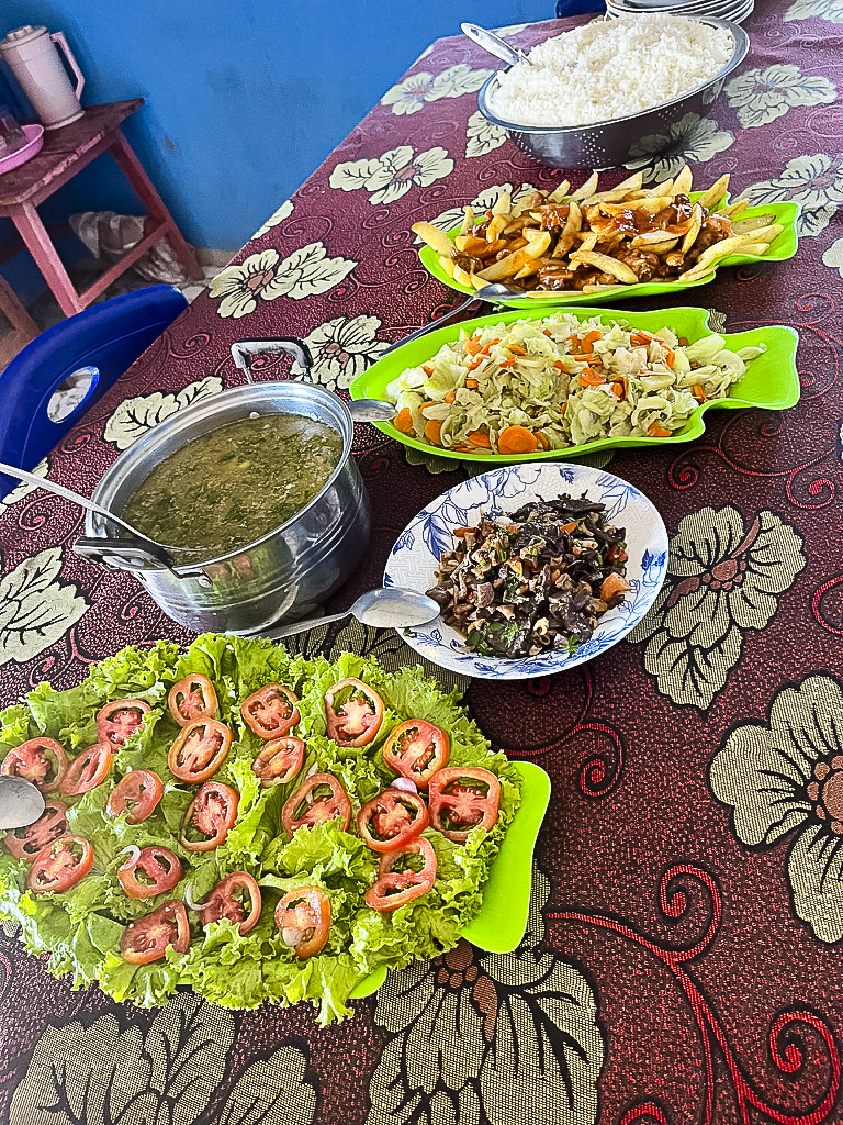
It’s 25 years since the 1999 ballot for independence, yet the destruction wrought by the departing Indonesians and Indonesia-trained militia is still evident: Houses are basic, and sanitation is almost non-existent. The loo is a squat toilet with a mandi shower (a bucket and a tub of water) nearby; we share it with the village. It’s all about hand sanitiser and trying to keep ourselves well. We sit down in a neighbouring family’s home for a Timorese dinner—a variation of rice, two-minute noodles, vegetable and meat soup, fried fish, chicken, beans and greens—and watch the sun go down between trees in the distance. Tomorrow, it begins.
There’s no rush on the first morning and we leave after 9AM. Breakfast is local paun (bread roll) filled with fried eggs or our Dili-bought peanut butter and/or jam. Luckily for me and my minor coffee addiction, Maddog also runs coffee tours in-country, and they bring along plungers and a supply of top-notch coffee.
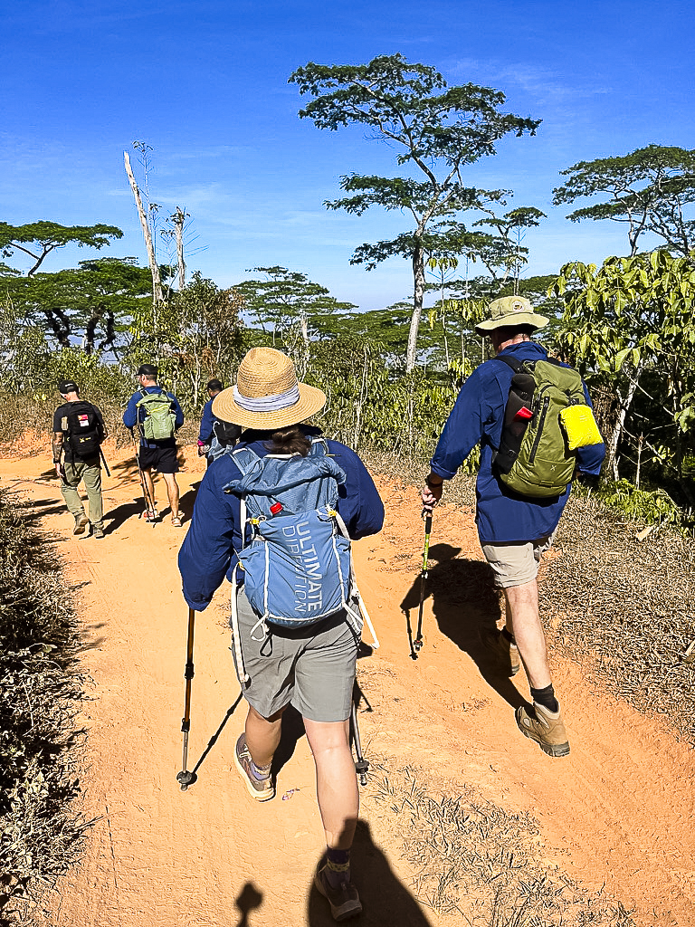
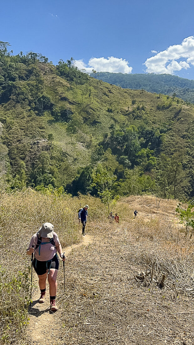
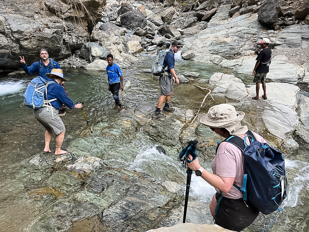
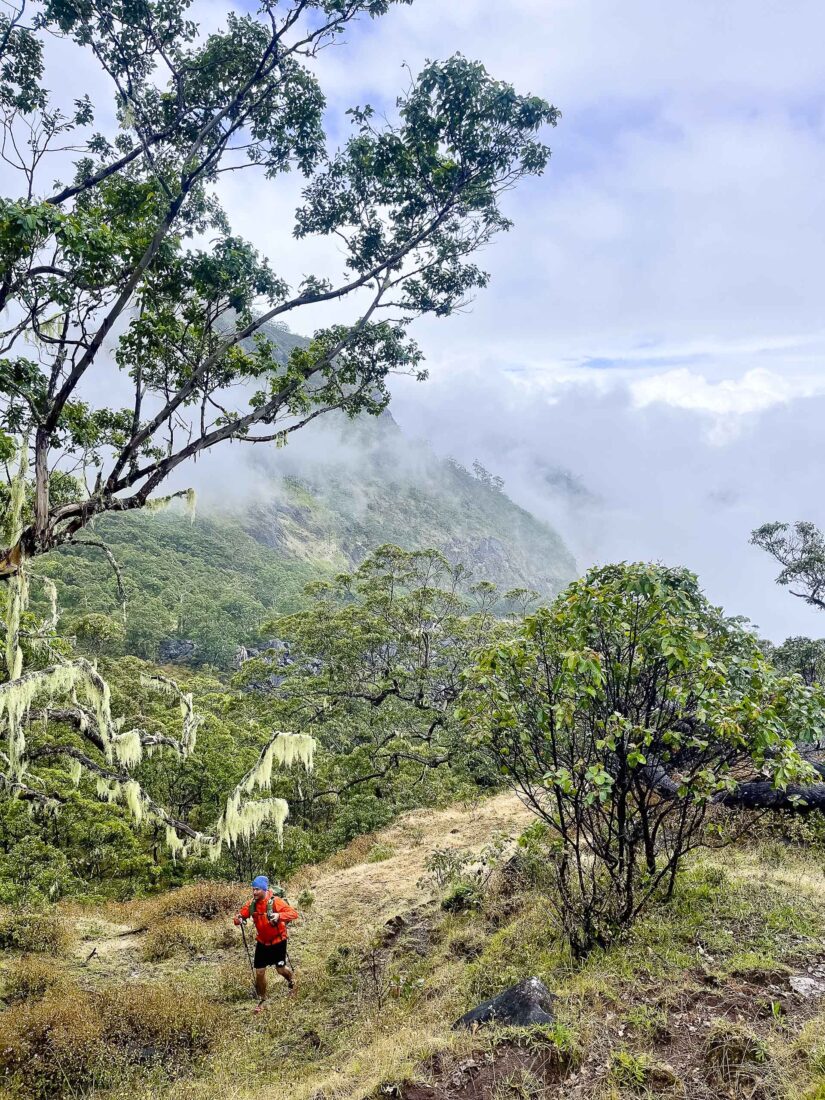
Our packs get tied onto the Troopy (you can carry your own pack, but I figure the hike will be hard enough) and we begin, with 12km to walk on our first day. Starting above 800m asl, we head down narrow trails to below 400m to our first river crossing, where we keep our feet dry by jumping from one large boulder to the next. We zip up from the river abruptly, scrambling at points, with shale splitting away from the contact with our feet, causing me to slip and slide. I grab onto branches and regularly need to abandon my hiking poles to get a better grip. The terrain levels out, and we have lunch in another family home, then climb back up to the 800m we started at and hit 1,300m. I’m feeling satisfied to put to bed a great day of hiking. Up high in Timor-Leste’s interior, it’s cool enough to be comfortable.
Guy the historian is on the hike too, pointing out areas that featured in the stories he told us on the Battlefields of Dili tour. After a sleep interrupted by community karaoke, barking dogs, and—when the dogs finally exhausted themselves—roosters crowing, we walk to the crumbling former hospital in Hatolia. This is where WW2 Australian soldiers and kriadu would have walked to, transporting one of the commandos, Private Allan Hollow, who’d had his jaw blown off. Australian Dr Roger Dunkley fixed him up before he was evacuated from the country weeks later by an American flying boat.
Hatolia is also where, on 13 March 1942, Australian David Ross, the British Consul-General, met with the Aussie commandos holding a surrender demand from the Japanese. The initial reaction from the soldiers was reportedly, Surrender? Surrender, be fucked! (This is how the hike got its ‘No Surrender!’ name.) By then, there were 350 Australians in Timor—hardly enough to deflect or defeat 3,000 Japanese—but they caused mayhem when they could, waging a campaign of annoyance against the Japanese, and killing many, until departing (along with the 2/4 who followed them) without surrendering.
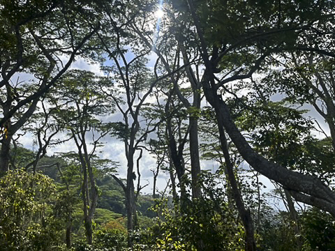
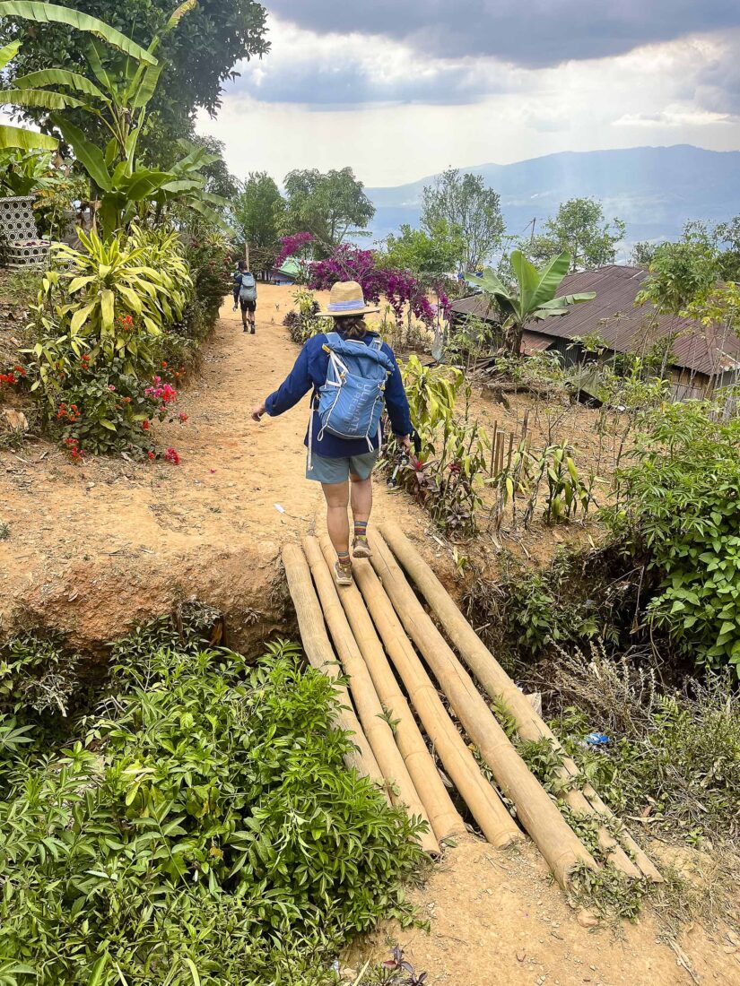
But it’s not only military history that I’m learning about. As I hike, I discover a land of rust-coloured dirt with eucalypt forests, with exposed plains bisected by wide, rocky rivers reduced to streams, and, most striking of all, with shade trees for the coffee. Planted by the Portuguese who brought coffee to Timor, they’ve since grown so high that they barely do the job they’re supposed to do: shade the coffee plants beneath them. As we walk along high ridges, we can see their photogenic waves of green in the valleys below.
On Day Four, we zigzag down through the deep-green coffee plants to a wild, flowing river. Is there anything better on Earth? We reach the bank and debate taking off our boots to cross; we end up crossing, then stripping down to swim anyway. It’s hot, and the water and small waterfall are beautifully refreshing. Minutes after we put our daypacks back on and resume hiking—another big ascent into a small village—our clothes are dry.
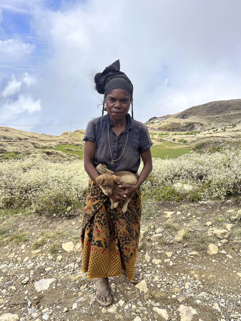
The Timorese we meet on our hike are welcoming and enthusiastic. Some want to chat; some are bemused when we pop up, one by one, from their backyards and onto the roads. Their dogs have usually raised the alarm already, but seeing hikers using local trails they’ve used for decades doesn’t seem to surprise them.
At the morning briefings, I want to know two things: How many kilometres are we walking, and how much elevation are we gaining? But after Day One, I already know the answers: Firstly, between 12-23km, and secondly, probably lots. Many trail runners and other hikers have been taken on this route before, but it’s evolving: We walk mostly on singletrack and sometimes on dirt roads, taking dalan quarte (‘short cut’ in Tetum) if they look more fun. But the dirt roads are usually just fine for hiking, and we take advantage of being able to walk on them side-by-side, catching up with each other and absorbing the extraordinary landscapes together. Taking dalan quarte between road switchbacks becomes the norm; we disappear up off the road and into the bushes like any local would.
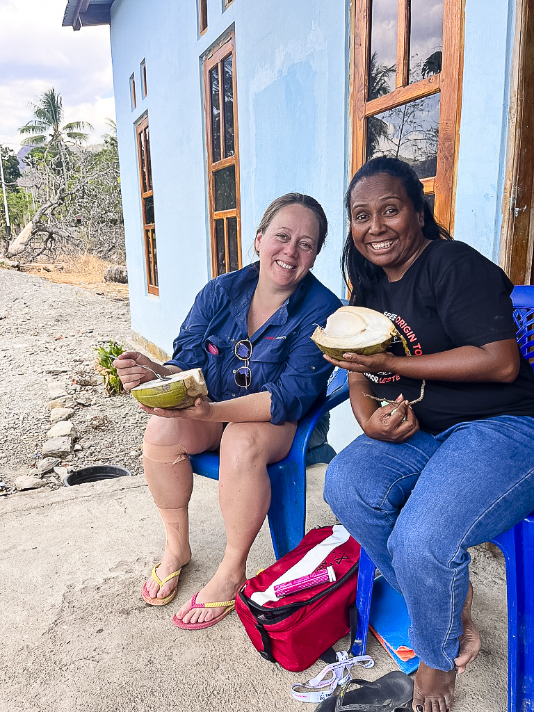
That’s not all we do like the locals; we eat like them too. A keen snacker, when I walk into villages, I find the local kiosk and buy up its entire supply of Beng Bengs (chocolate and caramel wafers with crispy rice wrapped in chocolate) to eat and share. Our main meals, as well, are supplied by the villagers: We arrive in town, settle in and are soon sitting at a large table laid out with bean broths with meaty chunks, bottomless rice, and on a few days, enough instant noodles to feed us many times over. Each stop has a different version of ai manas (sour and spicy chilli sauce), and I love loading a few delicious spoons of the spicy stuff onto my plate and then enjoying its mouth-exploding effect.
After one lunch, the owners show us an eerie concrete bunker under their house used by the resistance movement to store documents during the Indonesian occupation. After being forewarned that the Indonesians were looking for them, the locals cleared it out, and when the bunker was discovered, it was empty.
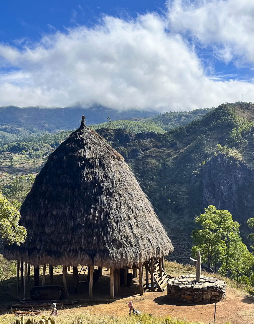
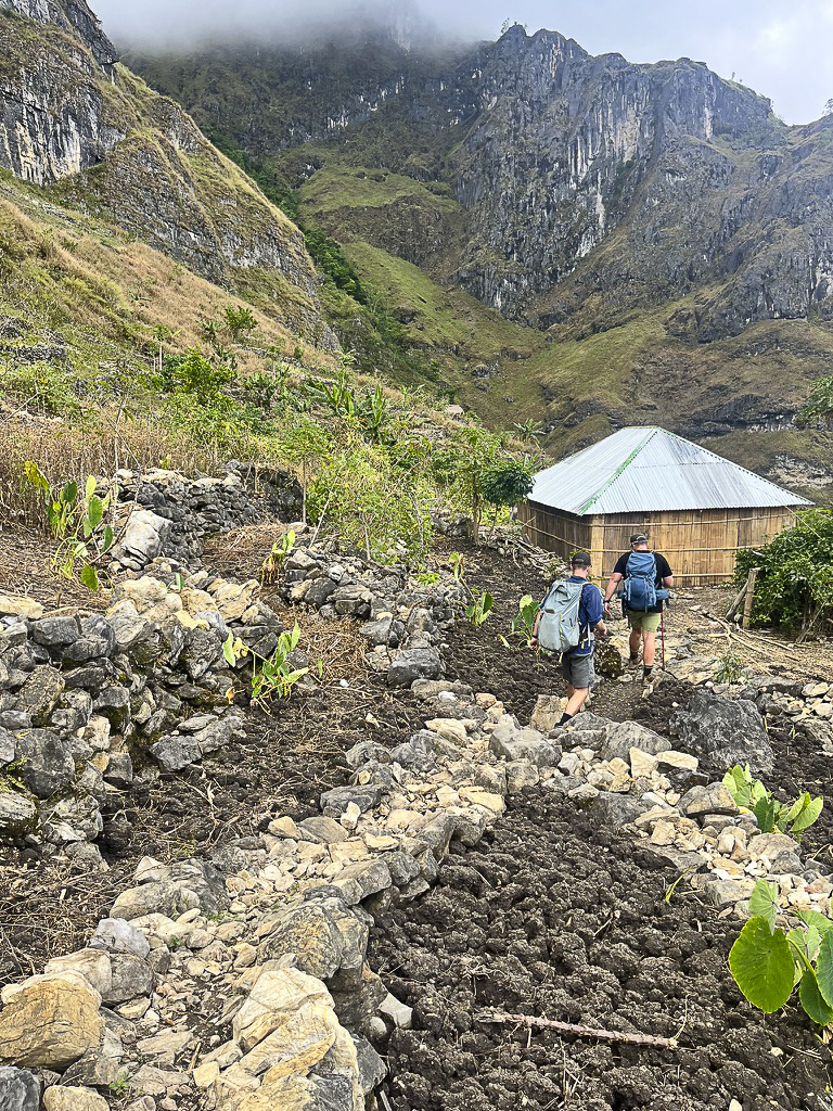
We end up spending two nights in tents, three in guesthouses, and one—my favourite—in our sleeping bags on the top level of an uma lulik (traditional house). With a roof over us but open air on all sides, we—and the mountains we are yet to climb—are lit up by the full moon. To reach this magical spot, we take a dalan quarte which isn’t actually a short cut. Instead, on a ‘long cut’ that I have no doubt will be added to future trips, we are taken around a mountaintop we were supposed to approach from the other way. However, life lesson: Going the ‘wrong way’ can result in stunning vistas and be better than the original (even if I nearly bonk and am convinced, as I shuffle along, that we are lost). We find a forest of ghostly white gum trees, then hike singletrack alongside a cliff face, before meeting the dusty road to our uma lulik.
But the intriguing and circuitous route seems emblematic of the intersecting tracks all over Timor-Leste: There’s nothing linear. The tracks we take are like those the Australian WW2 commandos would have walked, and they’re still frequently walked by locals.
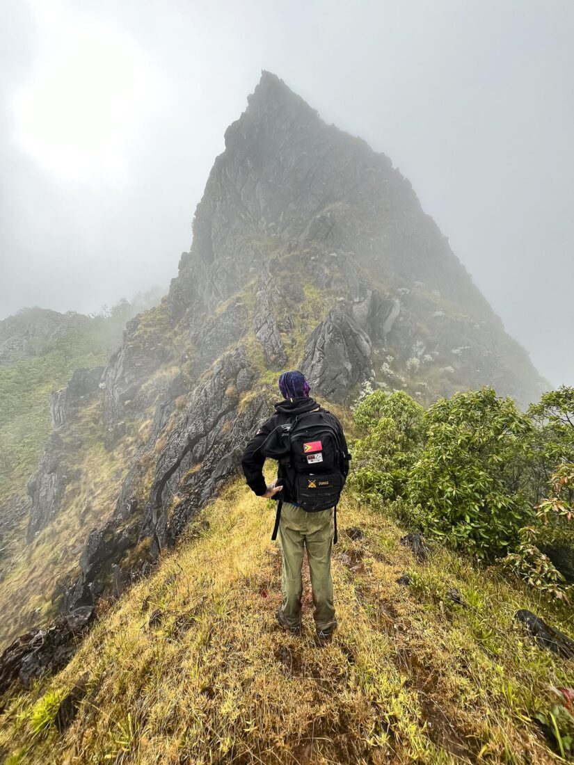
On our second-last day, we bump into traders with Timor ponies loaded up with produce; they’re heading to markets in Atsabe, where we’d just walked from. This is the day I am most excited about, and most daunted by: Ahead lies a climb the back way up the sacred mountain of Tatamailau (Mt Ramelau). At 2,963m, it’s Timor-Leste’s tallest peak. The usual route is from a car park, up steps then a well-worn trail to the summit. But coming via Atsabe, as we do, is not only technically more difficult, at around 23km and 1,745m elevation for the day, it’s longer and with more elevation overall.
We ascend tracks until we’re in the cool clouds, just able to make out the mountains around us. It is raining but we march on, slipping on and climbing around large, sharp, dark-grey, limestone outcrops while we follow the disappearing trail, which at points seems to veer off up impassable peaks. Suddenly, our path meets up with the main trail heading up (or down) Tatamailau, but we arrive here hours later than expected. The choice is ours: Head downhill, without summiting; or hike up for about 45 minutes, then descend for about an hour and a half in the dark.
I put my hand up for the ascent. We all put our hands up. We’ve come so far, and everyone wants to go up, despite it being our fifth day and despite a few of us feeling worse for wear. But, in the spirit of La Rende!, none of us are surrendering.
When I reach the statue of Na’i Feto (Mary) at the top of Tatamailau, I am wet, and tired, and emotional. We are in the drizzle; there is no sunset, or even view, to speak of (hikers usually start before dawn to watch the sun rise over the clouds) but it still feels incredible to be here. That feeling I’d struck at the start, that thing that had ‘switched on’ when I was walking earlier, dissolves me completely, and I can’t hold back my tears. I am rapt to have made it, and to have enjoyed the journey so much.
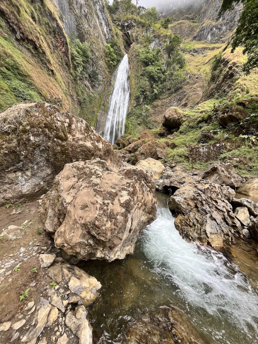
The descent is a quiet one. Our support vehicles meet us at the car park and drive us to our accommodation. We drink locally made sangria from porcelain cups, saying “Cheers!” to our efforts. But rather than end with a mountain high, we finish with a waterfall low on the hike the next day. We head downhill for 14km through farms and small villages on high plains to find another Timor-Leste highlight: the spectacular Dokomali waterfall. Away from the main pool, I find solitude in a smaller pool where water bubbles up. I giggle to myself at the thought of it: I’m in a bubbly natural spa, surrounded by towering cliffs and a majestic waterfall in the middle of Timor-Leste. And I walked here. It really is the unexpected in the unexplored, and, yes, it really is life changing.
If you liked this piece, you should subscribe to the print mag. Only a fraction of the great stories we run in the mag make it to our website; if you want to read them, head to subscribe.wild.com.au.