Daisetsuzan National Park: Hiking the Volcanic Heart of Hokkaido
Words and Photography: Brendan Reeves
(This piece was a content partnership originally featured in Wild #198, Summer 2025)
The pressures of everyday life, running a business and long-haul flights feel far away stepping into the volcanic heart of Hokkaido, Japan. I had come in search of stillness and immersion, a walk lasting more than a day and free from tents and ration packs. A walk where I could carry nothing more than a small daypack and finish each hiking day with a good meal, a decent place to sleep, and the luxury of bathing. In short, I didn’t want to have to think too much.
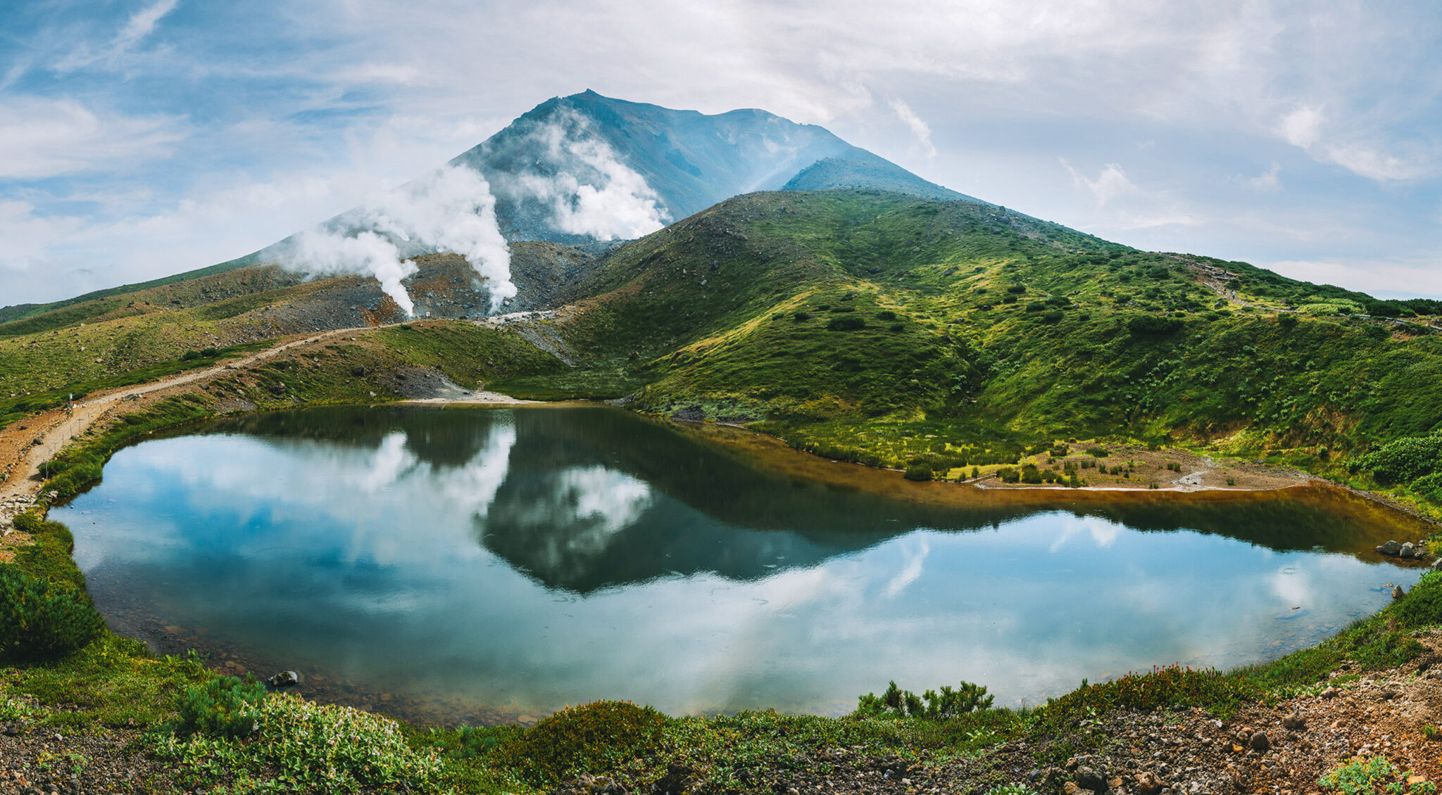
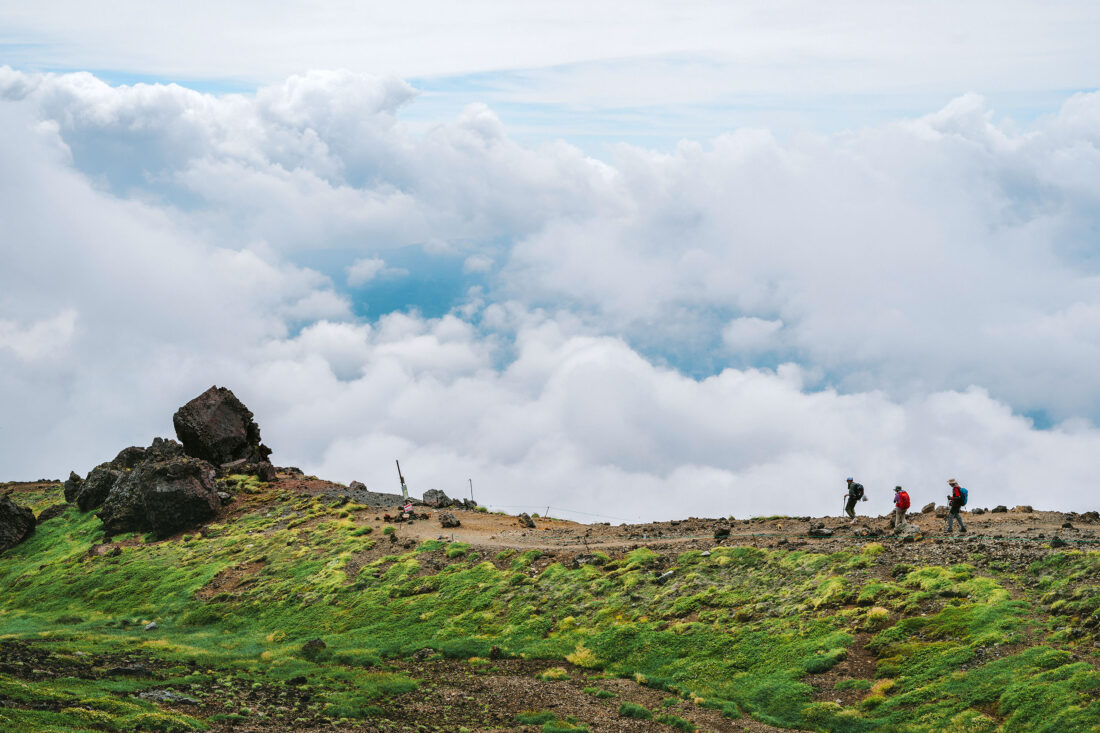
Japan’s northern mountains are modest in elevation, compared to the Himalayas or the Alps. The drama of the Daisetsuzan National Park is not in lofty summits seen from below, but in what happens once you step inside the range itself.
Daisetsuzan, which means the ‘great snow mountains’, is actually a cluster of volcanoes built over millions of years of fire and eruption, their layers of ash and lava stacked like pages in a long geological book. From the base at 200 metres above sea level to the high plateau around 1600 metres, the land tells its story in ridges, craters, fumaroles, and mineral-painted slopes. It’s alive and breathing, and you can see it and sense it once you’re there.
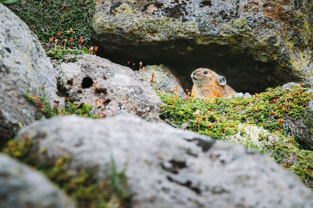
It is a place where snow lingers into summer, where pika, the tiny alpine lagomorph mammal that survived the last Ice Age squeaks from the rocks, a place where every step reminds you that this land is restless. It’s really something to be experienced for yourself, and is a manageable hike for most hikers of reasonable fitness.
For three days, guided by Aya, a local mountain guide, I walked across this volcanic cluster. Aya’s knowledge went far beyond navigation: She translated signs, identified alpine flowers, and explained the geology. On offer was something quite rare these days—relief from decision-making and a chance to walk with unburdened attention. How often do we get a chance to do that?
Day One. Tokachidake’s Volcanic Spine
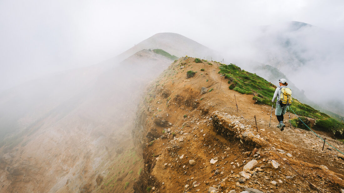
From Furano, it was an hour’s drive to the Tokachidake trailhead. The climb began steeply, flowers bright against black soil, until we reached the ridge where clouds drifted in and butterflies wove between us. Ahead, Aya pointed out two possible summits—Furano-dake or Tokachi-dake. Clearer weather drew us along the ridge towards Tokachi; it was as simple a decision as that.
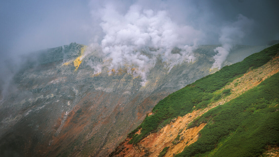
Here the mountain showed its character. Steam puffed from vents; slopes were streaked red, yellow, and grey; and craters were carved into its flanks. At over 2,000 metres, the summit was wreathed in cloud, but that only deepened the sense of mystery. We paused and ate onigiri, a simple but perfect hiking lunch, and watched the wind carry sulphur-filled mist across the ridgeline.
On the descent, we crossed sandy ridges and crater bowls before reaching Ryounkaku Lodge. This family-run lodge is more than a place to sleep; it’s part of this land’s history. The owner’s grandfather once mapped these trails by hand. From the lodge’s windows, I saw the volcanic arc stretching into the distance. And in the mineral-rich onsen, I felt the ache of the day’s 11.6 kilometre walk dissolve into warmth. It felt great.
Hiker’s Note on Tokachidake:
Medium to hard, steep early sections, loose volcanic footing, exposed ridge. Distance: 11.6 km return. Highlights: ridge walk, active vents, mid-mountain craters.
Day Two. Asahidake, Summit of Fire
With muscles still a bit achy from the first day, riding the ropeway was welcome, and it lifted us to the 1,600 metre plateau below Asahidake. This is Hokkaido’s highest peak (2,291 metres) and, in geological terms, its youngest, an active volcano still shaping itself. Even here, at the ropeway’s end, the drama was close: fumaroles hissed, alpine flowers were scattered in the ash, and clouds rolled over ridges.
We climbed slowly, pausing to breathe in both silence and oxygen mixed with the sulphur. At the summit, clouds swirled and parted in sudden moments, revealing a panorama of not one mountain but many. From here you see the truth of Daisetsuzan, a collection of volcanic cones, layered plateaus, and calderas born from ancient fire.

That night we stayed in Sounkyo Onsen, a larger resort town set deep in a gorge. My room looked across the valley, but what captivated me even more was the rooftop onsen—an open-air pool on the fifth floor—where I soaked while clouds curled through the canyon.
Hiker’s Note on Asahidake:
Easy to medium; ropeway access to 1600m plateau, summit climb more demanding but not technical. Distance: 5 km return from the ropeway. Highlights: summit views, fumaroles, alpine flora.
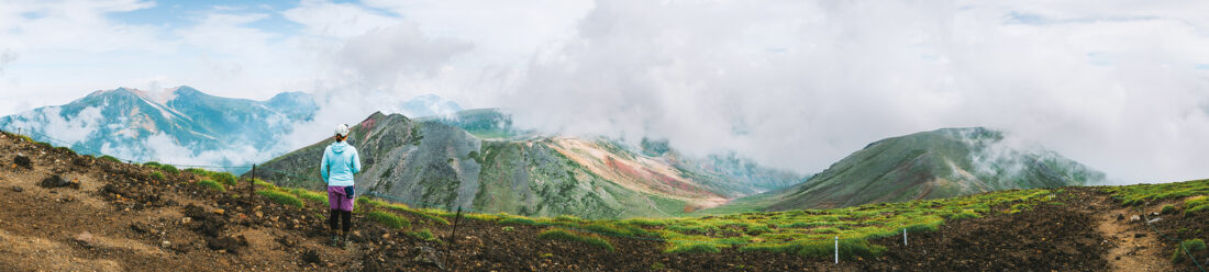
Day Three. Kurodake and Ohachi Crater
At dawn we rode the first ropeway from Sounkyo, the valley below filled with inversion clouds. A chairlift carried us to 1,500 metres, where we entered dwarf pine and sasa grass before ascending to Kurodake summit (1,984 metres) as a sidestop to Ohachi Crater. Though modest in height (at 2,000 metres, lower than Australia’s Kosciuszko), the sense of scale here really was incredible, and we stopped to marvel at it.
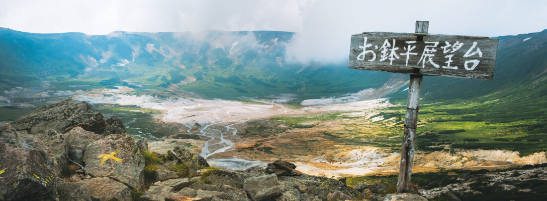
Kurodake stands on the plateau built from ancient lava, ash, and stone, a foundation for the entire volcanic range. Descending slightly, we reached a volcanic plateau and the rim of the Ohachi Caldera, a vast bowl with streaked mineral walls and a river bubbling from its floor. Snow still lingered in gullies even in late summer. Here, too, we heard the high-pitched call of the pika, descendants of the Ice Age, living fossils clinging to rocky slopes.
The trail was busier here, it being the Obon holiday and Mountain Day, a national celebration of mountains. Yet even with company, the land’s dramatic landscape was overwhelming. By the time we returned to the ropeway, clouds were lifting, and the volcanic cluster stretched away in ripples of ash-grey ridges.
Hiker’s Note on Kurodake:
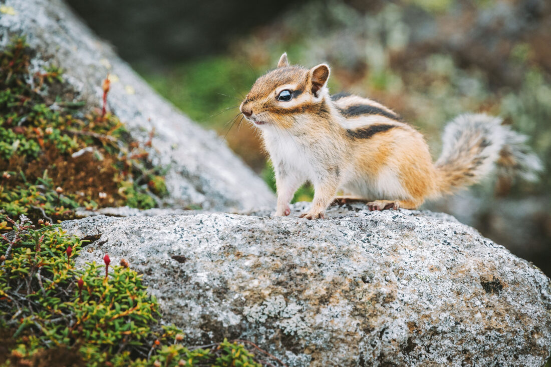
Easy to medium; ropeway and chairlift assist, short but steep final ascent. Distance: ~4 km return. Highlights: caldera rim, inversion clouds, wildlife sightings (pika, chipmunks, deer).
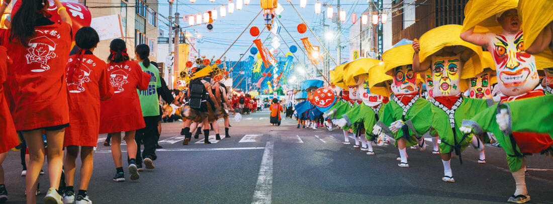
The Human Layer, Festivals and Art
Daisetsuzan’s story is not only geological. In Furano, I got to experience the Hokkai Heso Matsuri (Belly Button Festival), where locals paint faces on their stomachs, a playful nod to Furano’s place as Hokkaido’s belly button or centre. It was loud, joyful and very special to be there to witness.
In Kamifurano, the Gotō Sumio Museum of Art displayed sweeping 17-metre Nihonga canvases of the Tokachidake Range. Gotō captured what words strain to explain properly: The weight and drama of these volcanic forms; the fleeting moods of cloud and light that we walked through.
Both the festival and art showed me that these mountains shape culture as much as they shape land, and that’s extremely important. I recommend experiencing both these local cultural opportunities while there.
NOTES FOR HIKERS:
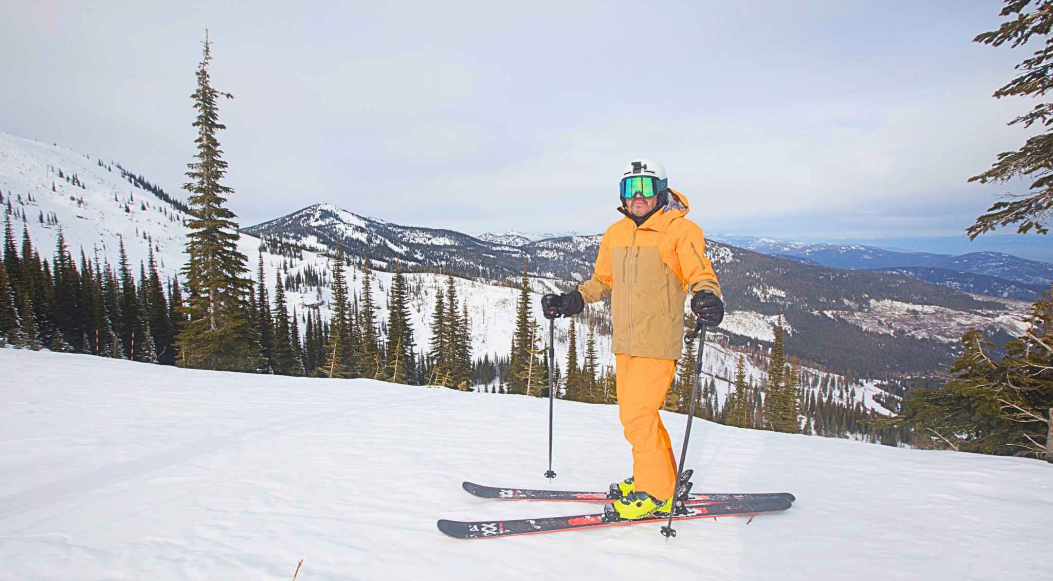
WILDLIFE: rown bears inhabit these ranges. Carry a bell to avoid surprise encounters, rent bear spray from MontBell shops (use only if charged), and never run. Back away slowly while speaking calmly
WEATHER: Conditions change rapidly. Cloud, rain, and sulphur fumes can disorient even experienced hikers. Dress for changeable conditions (not shorts and a t-shirt) and bring enough water, energy food and wet weather gear for worst-case scenarios.
TRANSPORT: Public transport links are irregular; self-driving or guided tours are the best options. Access via New Chitose Airport (2 hrs south of Furano) or Asahikawa Airport (1 hr from Furano).
GUIDES: Employing a local guide like Aya is highly recommended for safety and deepening your experience
MORE INFO: geoat.go-hokkaido.com