


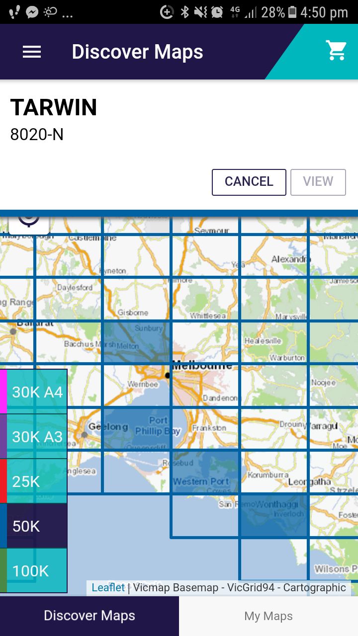
Heading to Victoria on your next adventure? Presuming you’re not keen on getting lost, you’re going to need up-to-date maps; the problem is that with more than 10,000 topographic maps across Victoria in four different scales, it’s not always easy figuring exactly what your cartographic needs are going to be. To help you find the right topo for your quest, Victoria’s Department of Environment, Land, Water and Planning (DELWP) has just released a new app—Vicmap Viewer. The app lets you—on your android or iOS mobile device—see which topos you’ll need for the area you’re heading, and then select and buy them.
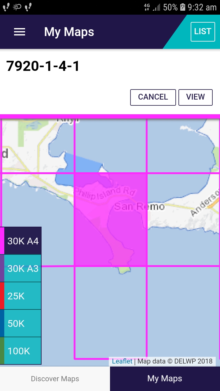
Maps can be chosen via a number of search parameters including map sheet name and number, locality/town, road name, address, the user’s geolocation and (soon to come) a Parks and Reserves search option. Then it’s a matter of deciding how much detail you’ll need—the app comes with available scales of 1:25 000, 1:30 000, 1:50 000 and 1;100 000—before you purchase them and download them directly to your device. All the maps downloaded are geoPDFs, making them prefect for use with secondary apps like Avenza which let you use your phone’s GPS to geolocate your position on the map. (For anyone who hasn’t used a geoPDF on their phone before, it’s worthwhile stating you don’t need a connection to view your downloaded maps.) Maps purchased and downloaded by the Vicmaps Viewer can, of course, be printed as well, so you can head out bush armed with both digital and hard copies of the maps.
While the app is available for free, individual maps have the same pricing arrangements as the current DELWP online service. And as with the online service, maps available from the app are updated every 18 months from Vicmap, Victoria’s’ maintained spatial dataset.
For more info: delwp.vic.gov.au/vicmapviewer