Wild Bunch: 5 Overnight Walks around the Snowy Plains
Words & Photography: John Chapman
(This story originally featured in Wild #195, Autumn 2025)
Disclaimer: Track conditions, access, campsites and rules may have changed since publication.
The Snowy Plains provide access from the south into one of the most diverse bushwalking areas in the Victorian Alps. Gorges, waterfalls, high ridges with extensive views and rugged, rocky summits are some of the features to be found in this area. Access is by sealed road from Gippsland to the tiny town of Licola. From there the road to the Snowy Plains is initially sealed then becomes gravel as it starts climbing to the Snowy Plains. The higher peaks in the area are often under snow in winter and for most of the walks, mid-spring through to late autumn is a good time to attempt them. The exception is the Razor Viking Circuit as the road is closed before winter and does not reopen until around the Melbourne Cup weekend in November.
The Easy
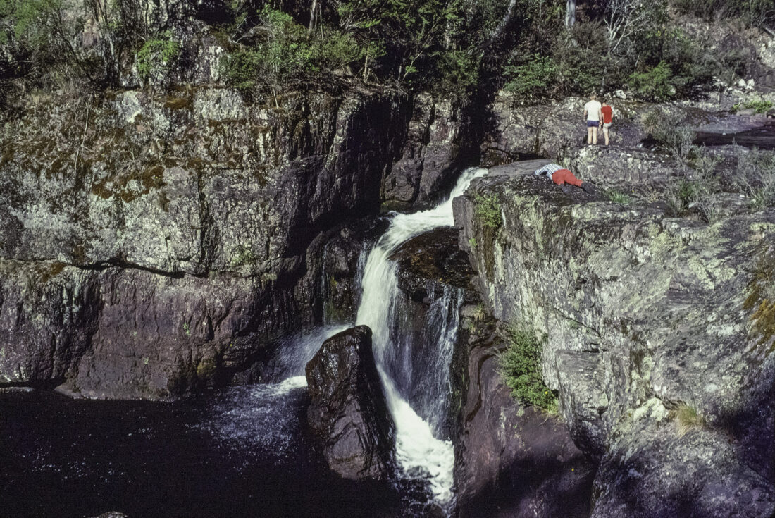
MOROKO GORGE
14km; 2 days; Medium
The rugged Moroka Gorge was first visited by Europeans in the 1860s, then its location was forgotten. A century later, in 1961, a lithograph print of the gorge was found, and after a long search the gorge was ‘rediscovered’. Visiting it has become a lot easier since, as a forestry road now crosses the headwaters of the river. The gorge is impressive, containing multiple waterfalls.
From Horseyard Creek, follow either of two tracks northward to the start of Moroka Gorge. The lower track is more scenic, passing an upper waterfall. Continue to a campsite near the creek, above the gorge. This is a short, easy walk of five kilometres with packs. The afternoon can be spent relaxing by the river or exploring the gorge. Without packs, head downstream following rough tracks on the gorge’s south side; there are four main waterfalls with the last being the highest. Return to camp. The next morning, you might wish to visit some of the falls again to see them in a different light then return to the start.
The Classic
LAKE KALI TARNG
18km; 2 days; Medium
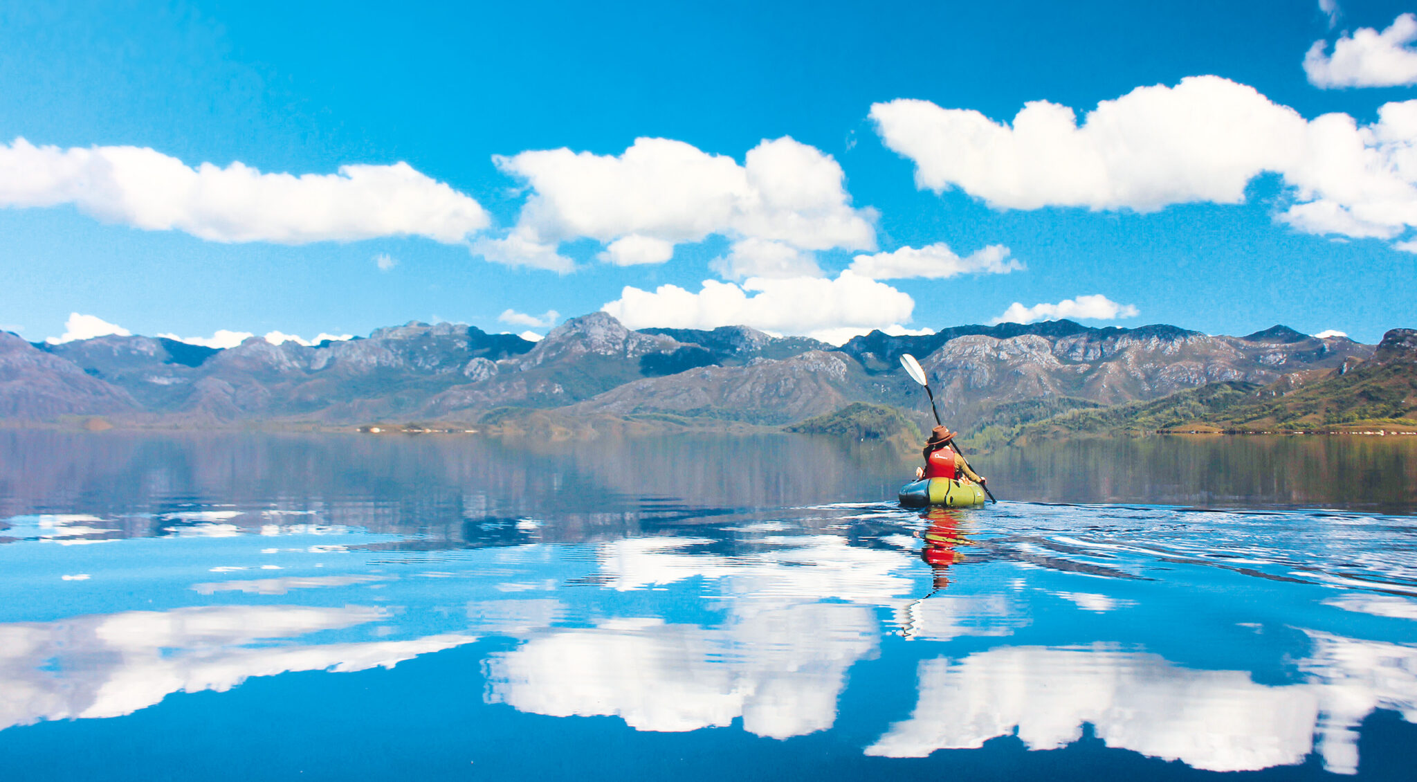
Lake Tali Karng is one of the rare natural lakes in the Victorian Alps. It was formed by a large landslide around 1,500 years ago. The lake is sacred to Aboriginal people, who are forbidden to visit. Non-Aboriginal people are allowed to visit, but you can’t camp withing 500m of the lake. The classic trip is not a circuit, but an easy car shuttle creates one by leaving a car near the bridge over the Wellington River on the way to the start at McFarlane Saddle.
The walk begins with a stroll across open alpine plains. There are several routes, and some will take the longer route to the summit of Mt Wellington and to visit Millers Hut. Pass the tank at Nyimba Camp, then a steep descent leads to Lake Tali Karng. If time allows, it’s worthwhile to circumnavigate the lake, exploring small waterfalls on Nigothoruk Creek. From the west side of the lake, follow the track south, passing over a low saddle and descend the Valley of Destruction to your choice of campsites beside the Wellington River. The next day, follow the Wellington River westward crossing it many times. At one point, it leaves the river to climb over Shaws Gap, then more river crossings lead to the sealed road at the end of the walk.

The Surprising
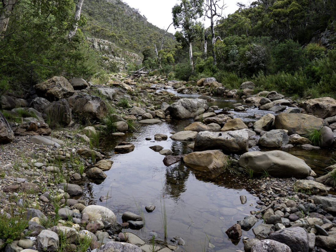
CRINOLINE-TAMBORITHA CIRCUIT
32km; 2 days; Medium-Hard
The Crinoline is an unusual peak being flanked by terraces of colourful red rock. While it can be climbed as a day trip from Breakfast Creek, the circuit is an enjoyable circuit walk that follows the high ridges. From Breakfast Creek climb a steep, eroded track to the main ridge then continue northward to The Crinoline. Climb the red rocky terraces to the lightly treed summit for views of the walk circuit. Leaving The Crinoline, collect water at Long Hill Creek then follow the high ridge to a scenic campsite on Long Hill or continue further on to the Rock Shelter to camp. Walking tracks then vehicle tracks are followed eastwards before turning south onto MacMillans Track. Rise gently to snowgums on the summit of Mt Tamboritha then a long spur is followed south-west crossing alpine meadows with views and passing through copses of trees. Descend steadily to the start at Breakfast Creek.

The Challenging
RAZOR-VIKING CIRCUIT
38km; 4 days; Hard
The Razor and The Viking are two prominent peaks in a wilderness zone. This is one of the most scenic walks in the Victorian Alps with sweeping views from rocky summits and knolls. It starts out being easy following good tracks, but they disappear and part of the route passes through thick trackless scrub requiring good navigation. It is a popular trip at Easter, however, water is often scarce at the second night’s campsite. Start from the car park for Macalister Springs and Mt Howitt. A good track leads to the hut at Macalister Springs. Continue to follow tracks to the Crosscut Saw, over Mt Buggery to camp on top of the cliffs on Mt Speculation. This is a very scenic spot. The next day continue following tracks to Catherine Saddle and over Mt Despair. The tracks become fainter as you climb The Razor before descending to Viking Saddle for the second night’s camp. Water is often very hard to find in this area and in dry spells carrying water is suggested. Next day, climb The Viking. From there tracks cease. Pass over South Viking then follow a scrubby spur south-east to the Wonnangatta River to camp. Climb south-east to meet a vehicle track, follow this then an old road formation to meet the walking track to Macalister Springs. A short walk south across Clover Plain brings you back to the start.
The Rarely Visited
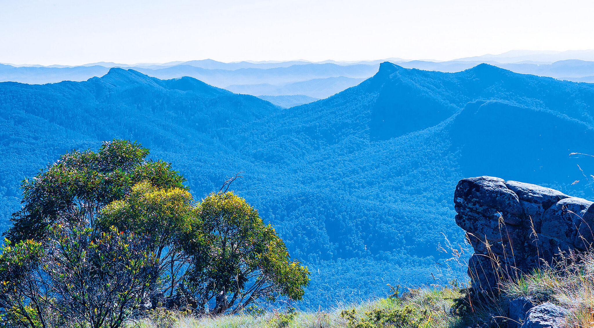
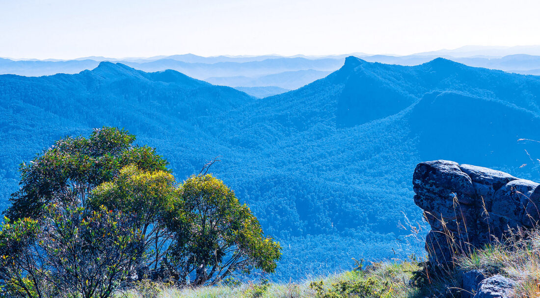
SNOWY BLUFF
26km; 3 days; Medium-Hard
Poised above the junction of the Wonnangatta and Moroka Rivers, Snowy Bluff with its extensive cliffs provides a commanding view of the Wonnangatta Valley. There are no tracks to its lofty summit which is guarded by bands of cliffs and scrub. The easiest approach is from the west but it is still a long scrubby climb. Start at Doolans Plain and follow a vehicle track down to the Moroka River. Wade across the river and climb the spur south of Snowy Bluff Creek to a waterfall. Cross the creek to a reasonable campsite poised on a spur high above the valley. Next morning a side trip follows a narrow scrubby spur northward to the main ridgeline. A scenic walk along the top of a line of cliffs leads to the timbered summit of Snowy Bluff. Panoramic views are available on the eastern summit. Return by the same route to the campsite. For the third day, reverse the first day’s walk to Doolan Plains. Do not attempt this route after heavy rain as the Moroka River can be very difficult to cross when flooded.
CONTRIBUTOR: Legendary guidebook author John Chapman doesn’t just know the trails around the Australian Alps; he wrote literally a book about walking their entire length. The Australian Alps Walking Track guidebook is available at wildearth.com.au
If you liked this piece, you should subscribe to the print mag. Only a fraction of the great stories we run in the mag make it to our website; if you want to read them, head to subscribe.wild.com.au