The Hoerikwaggo Trail
Words and photography: Janette Asche
(With an introduction by James McCormack)
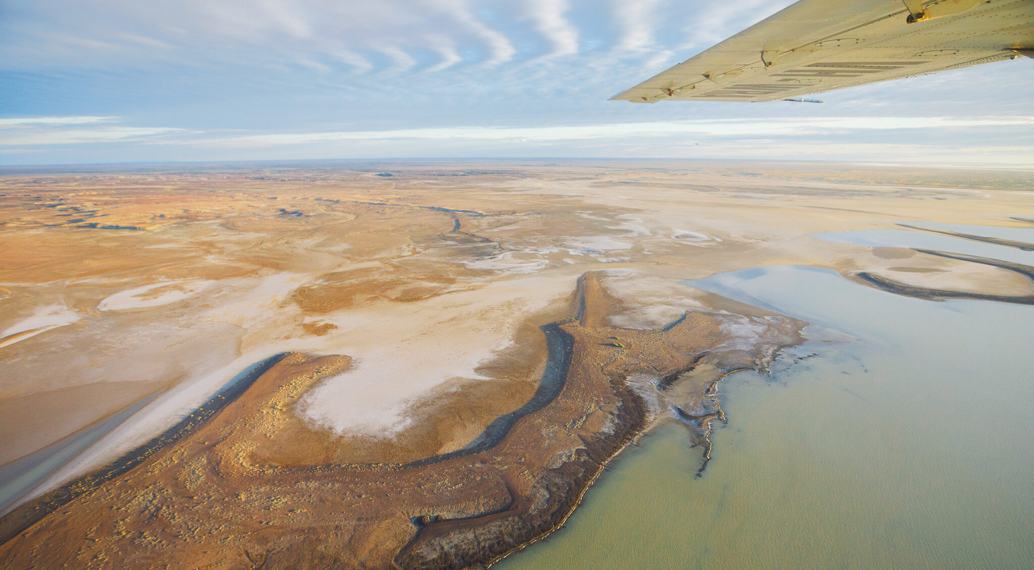
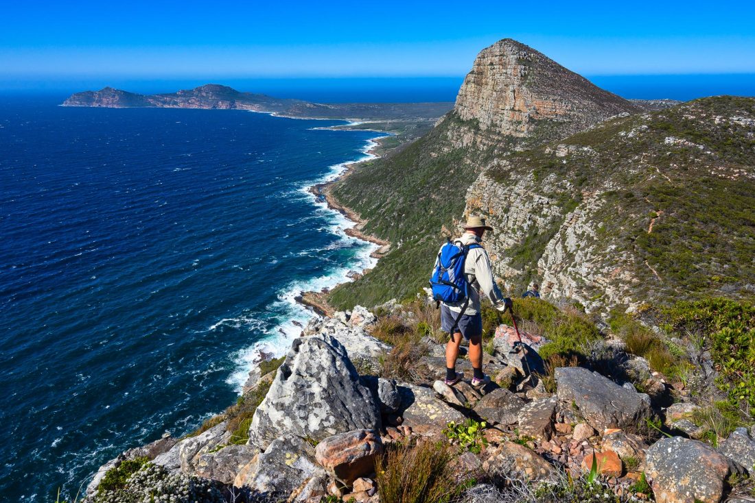
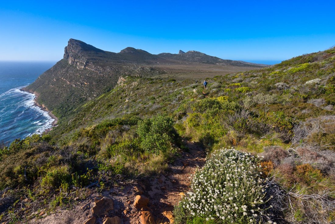
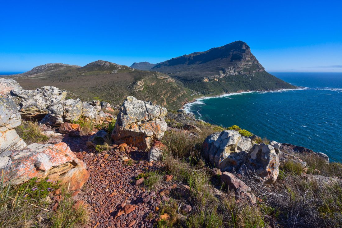
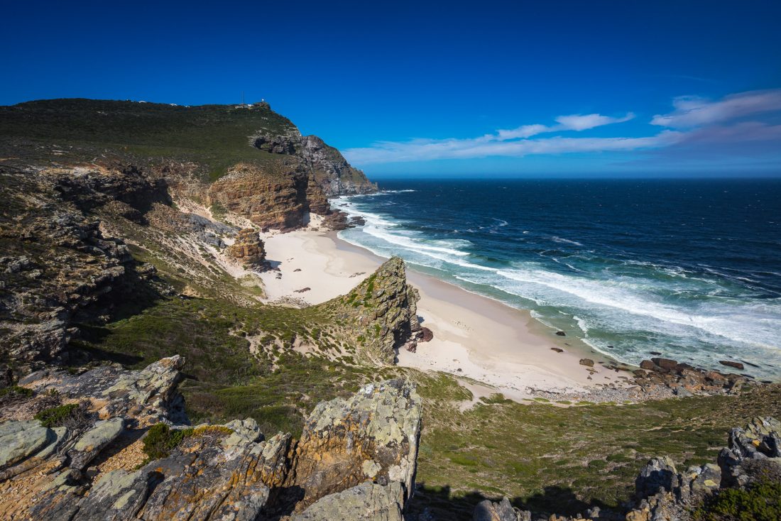
If you’ve ever seen a picture of South Africa’s Cape Town, then you’ve almost certainly seen a picture of the famous peak rising behind it: Table Mountain. Given the peak’s flat top, it’s an understandable name, but the Khoi Khoi—the area’s original indigenous inhabitants—gave the peak a more poetic name: “Hoerikwaggo”. It means “Mountain in the sea” and it aptly describes not just the peak, but also the trail of the same name that runs from Cape Point—near the Cape of Good Hope, the most southwesterly point of the African continent—to Cape Town, with a final day atop Table Mountain itself. The five-day walk runs spectacularly along cragged ridge tops and has endless views of stunning coastline and bright blue ocean waters.
Long-time Wild reader Janette Asche walked the Hoerikwaggo Trail back before COVID struck. We’re sharing here a bit of her story, and a collection of the stunning photos she took along the way. Here’s her account:
“After five weeks of mostly bus travel in Southern Africa, my husband and I were looking forward to finishing our travels with a hike to stretch our legs. We chose the Hoerikwaggo Trail, and pre-booked the hike with AWOL Tours.
While waiting for our guide to pick us up at our hotel early the first morning, I glanced at the previous day’s newspaper. The lead story was about an international film crew who had been robbed of all of their camera equipment at Silver Mine the day before. Silver Mine was originally part of the Hoerikwaggo Trail, but the huts were badly damaged in a bushfire a few years ago, so that part of the trail is no longer included—thank goodness for that!
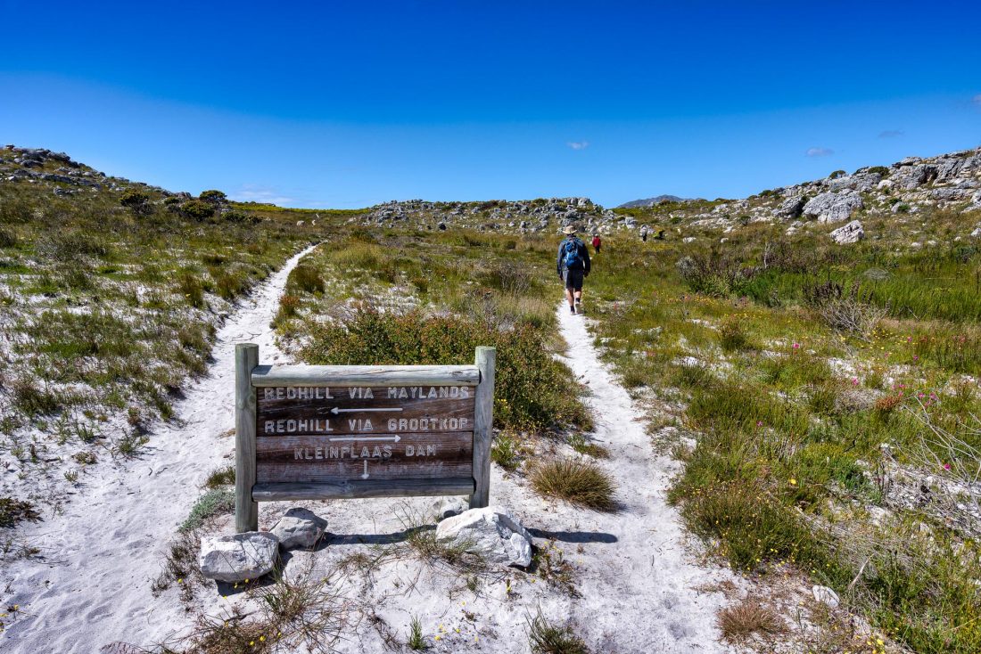
The trail was originally planned as a six day/five night thru-hike by South African National Parks for local and overseas visitors, supported by five comfortable, self-contained tented camps each with its own cooking hut and ablutions block including hot showers. The last of the camps was finished in about 2010. However, due to bushfire damage, private land access and security concerns, the Silver Mine section was taken out and the trail is currently in segments rather than an uninterrupted hike. All the huts are accessible by road, so most places had one or two others staying with their vehicles, but we were the only thru-walkers (although we did occasionally see day walkers).
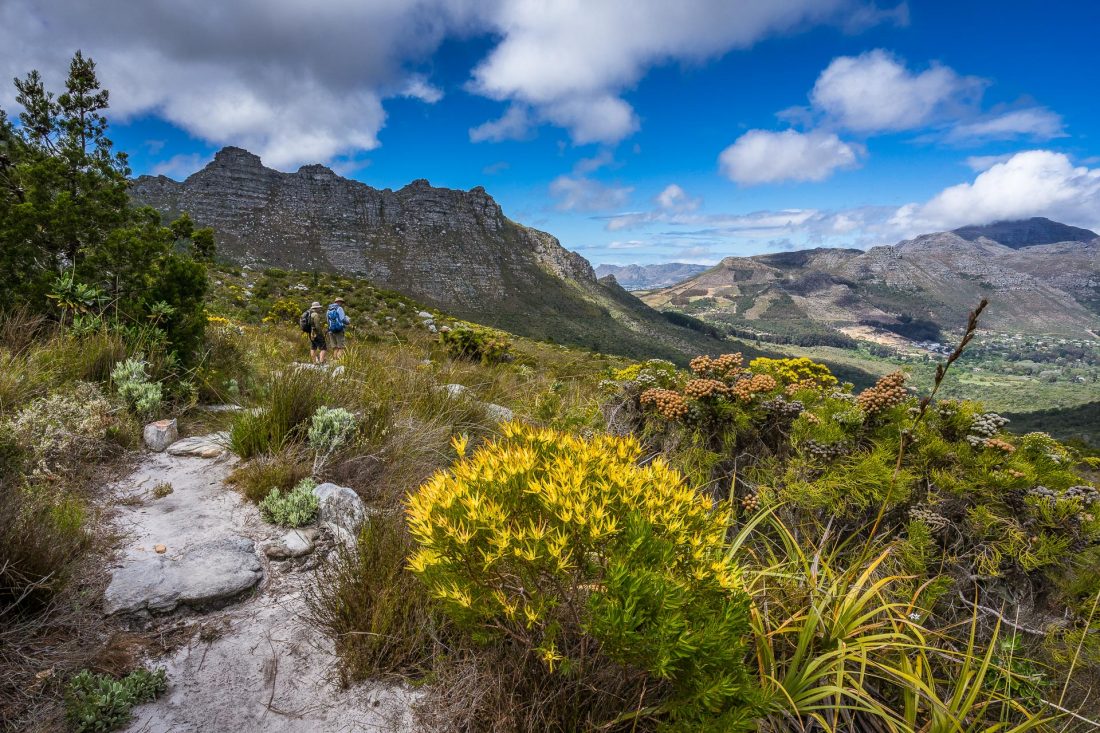
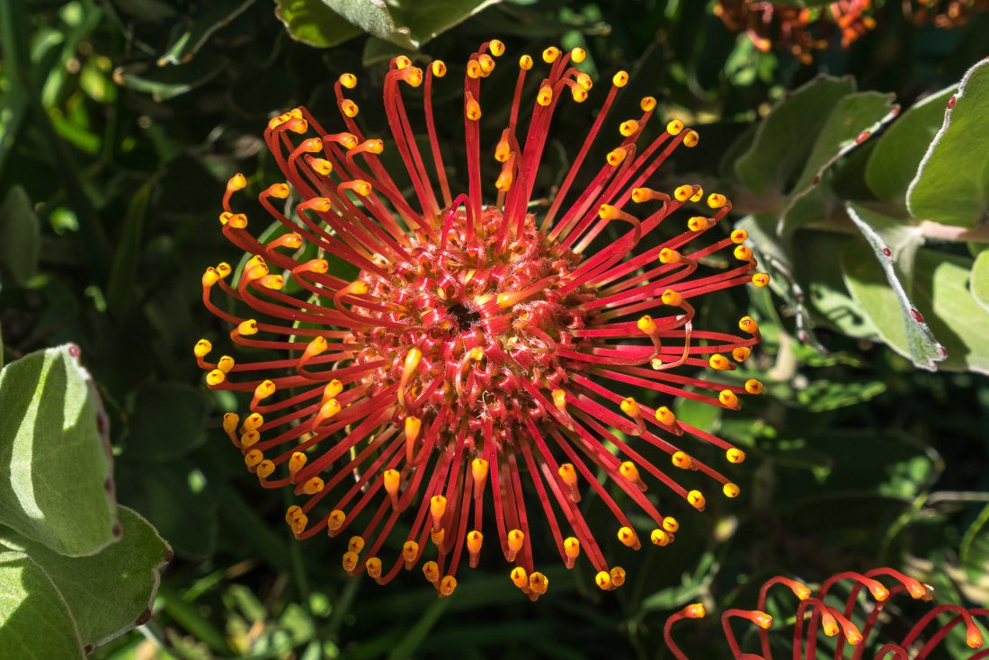
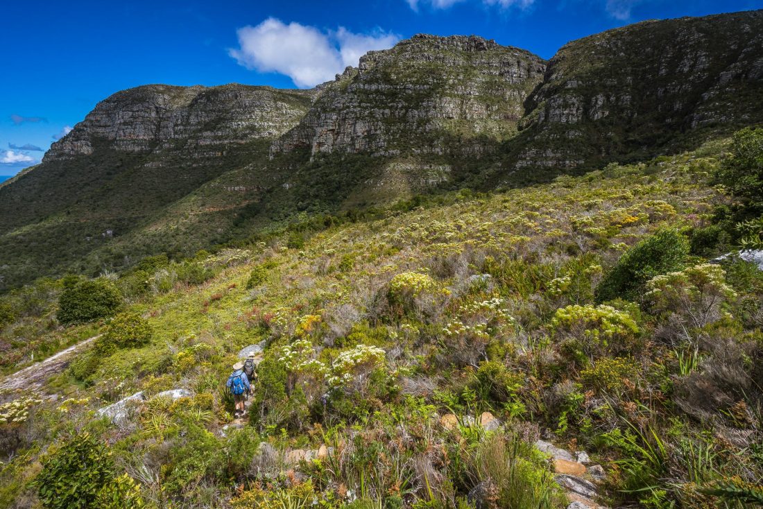
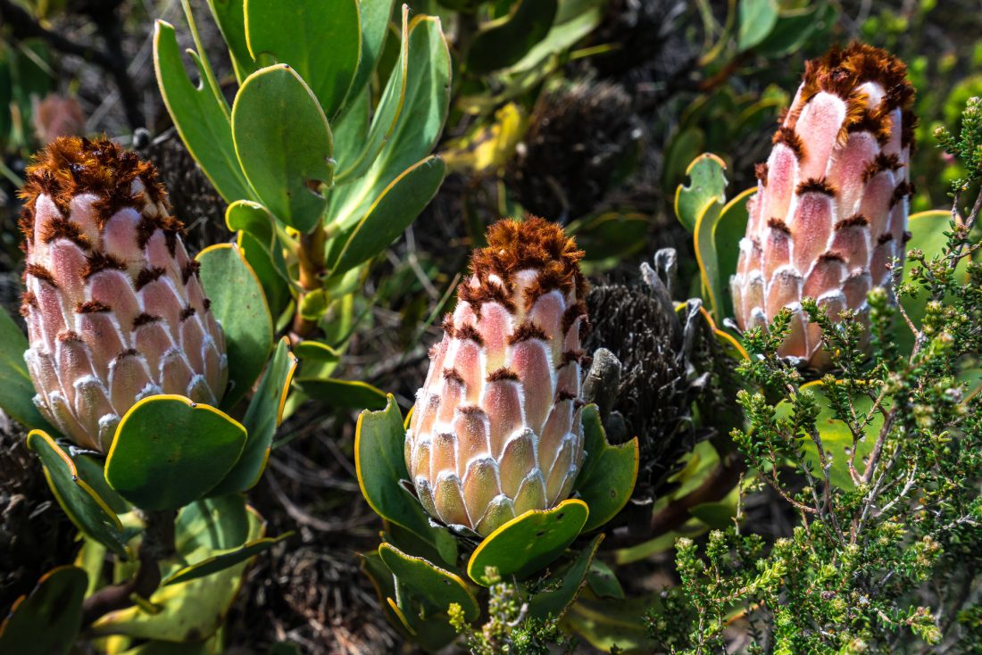
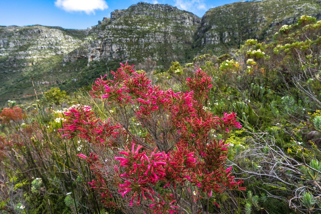
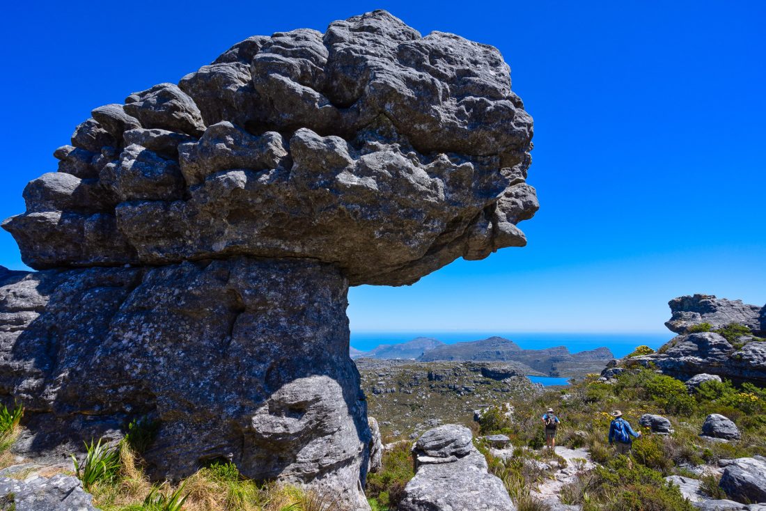
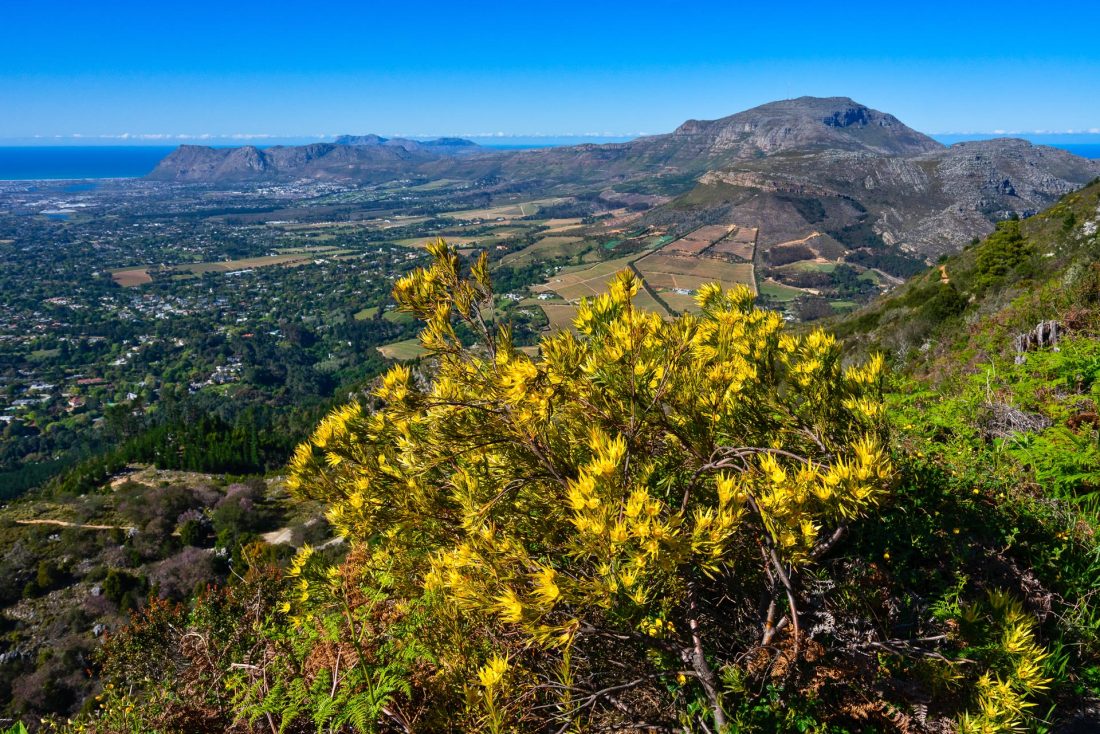
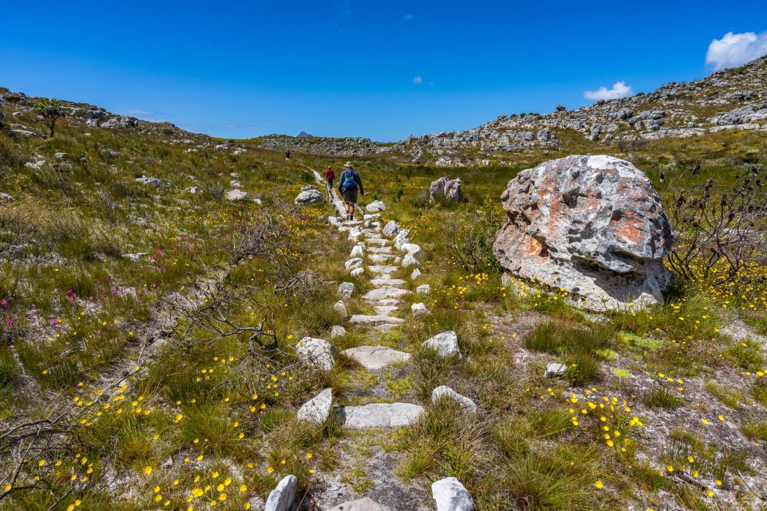
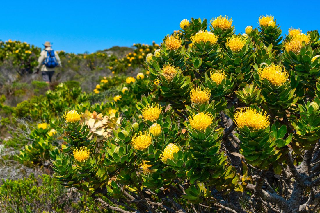
The scenery in this UNESCO World Heritage listed site was spectacular, as were the wildflowers and wildlife. Because of the rich biodiversity, the region is protected as the Cape Floristic Region under the World Heritage listing. The vegetation consists mainly of several different types of fynbos, which is a type of heathland and means ‘fine-leaved plants’ in Afrikaans. The most well-known and beautiful wildflowers from this area are the protea. The variety we saw was extraordinary. The wildflowers were a real highlight and I’d recommend Spring as being the best time to visit this region.
Day 1:
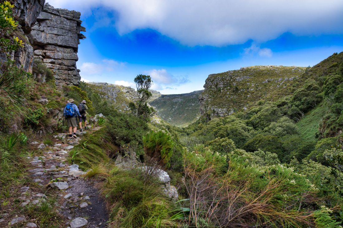
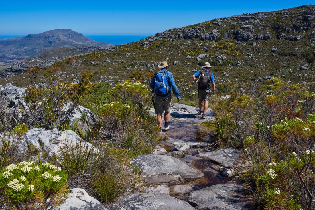
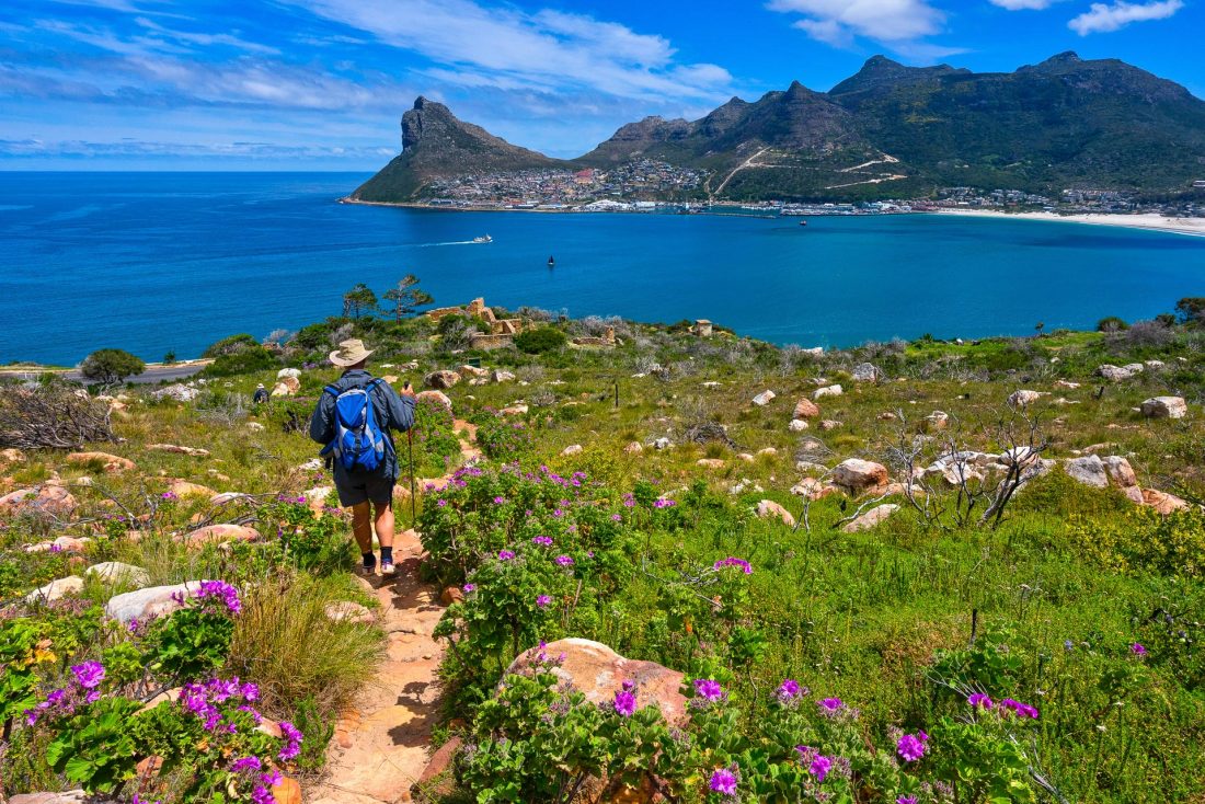
As our first day was a bit cloudy, our guide Jeremy suggested we walk an alternate route to our first night’s camp at Orange Kloof, and then spend two nights there, as the following day was forecast to be fine and all the better for summiting Table Mountain. Sounded good to us! So we headed off along the Pipe Track, in the shadow of Table Mountain. On the way, we passed some beautiful proteas—the first of many we would see. Then we went up Kasteelspoort, a pass between two of the Twelve Apostles, and then down Orange Kloof Gorge to the camp. To protect the rare Afro-montane forest in this area, only limited numbers of people are allowed to walk through Orange Kloof Gorge, and permission is needed. The small section of forest we walked through had beech trees, and I was reminded of Antarctic beech trees I have seen in Queensland’s Lamington National Park.
Day 2:
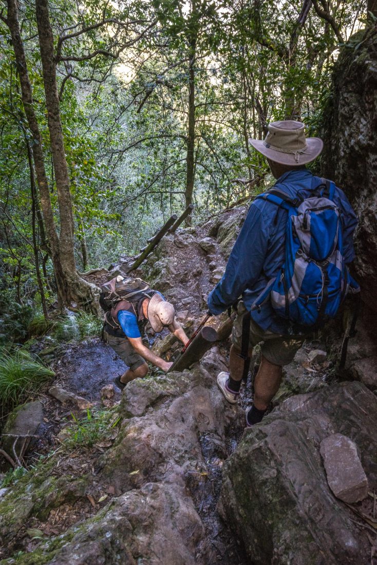
As predicted, the weather was perfect the next day. It was a short walk across to Constantia Nek, then a steady climb along what’s known as the Back Table to Maclear’s Beacon—a trig station sited on a huge cone of piled stones on the summit of Table Mountain. We walked approximately 10km, and over about 1000m in height, through interesting sandstone landscape and amazing wildflowers, with stunning views in all directions. We hardly saw another hiker, except at the start and at the summit. Rather than return the same way, we went down the interesting and steep Skeleton Gorge (with ladders in sections) to Kirstenbosch Botanical Gardens, where we took a taxi back to our camp. It was a long but rewarding day.


Day 3:
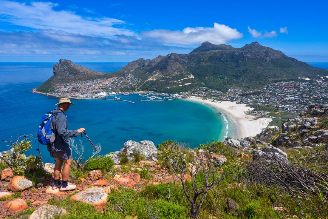
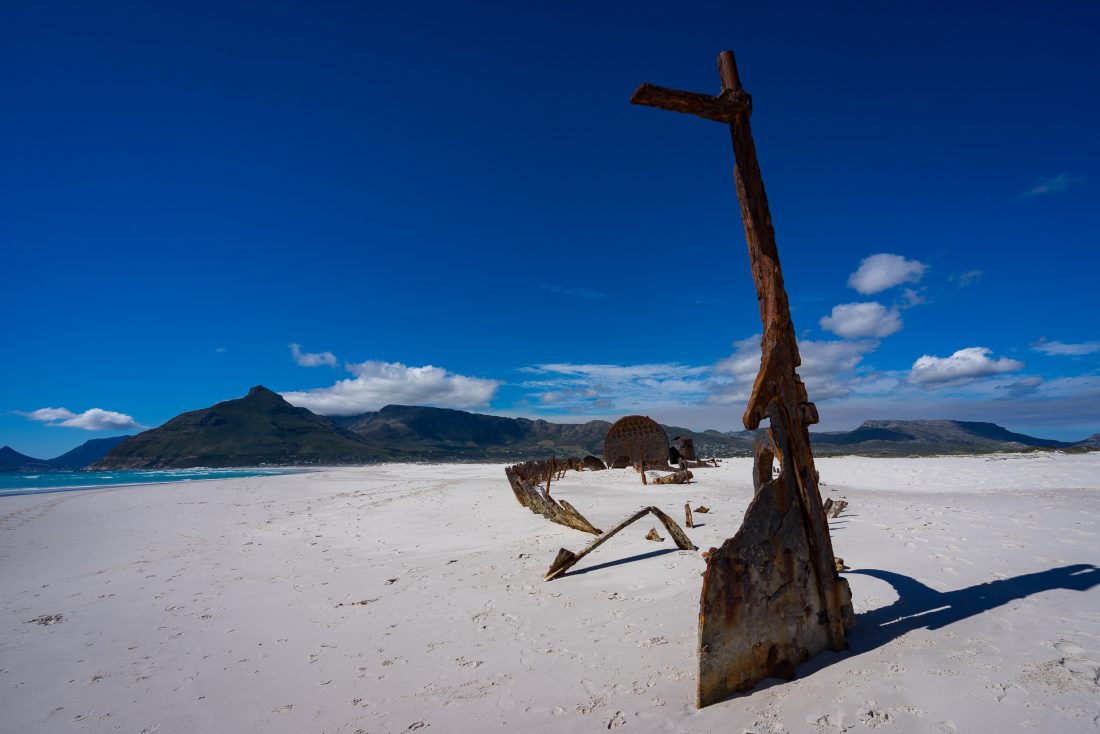
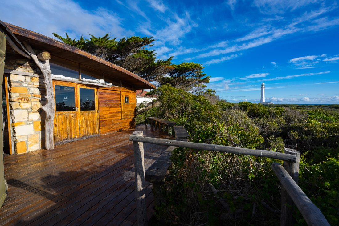
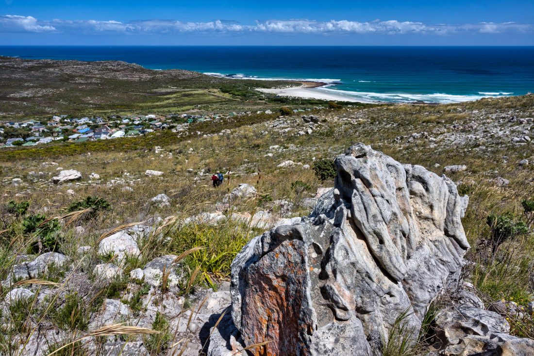
On our third day, we hiked from our camp to near Hout Bay, a distance of about 10km. We walked through more beautiful fynbos vegetation, with the ever-present stunning views of mountains and the ocean and hardly another soul about. As the landowner had closed off access to the next section, and with the Silver Mine area no longer on the itinerary, we were driven along Chapman Drive to Noordhoek. From there it was another 10km walk along the pristine white sands of Noordhoek Beach, passing a shipwreck from 1900, to our next night’s accommodation—the whale-themed Slangkop Tented Camp near Slangkop Point Lighthouse.
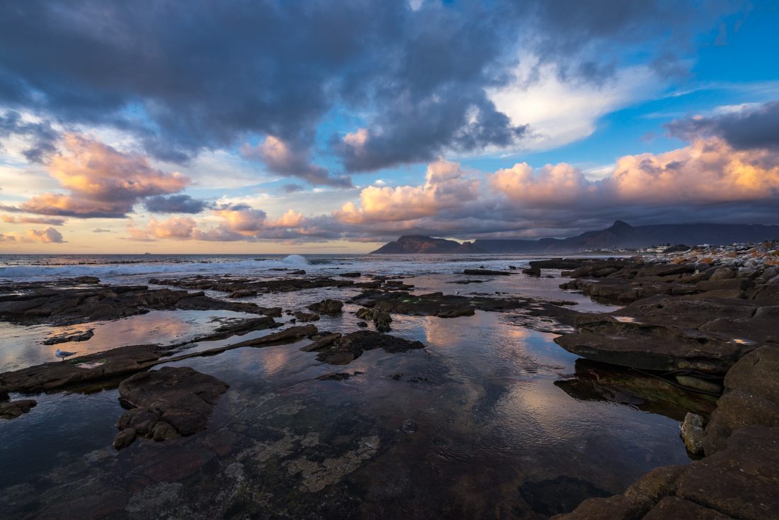
That evening, from the rocky ocean headland, I saw the first signs of a major bushfire on Table Mountain near Camp’s Bay; if we had started our walk two days later, we wouldn’t have been able to walk through Orange Kloof or stay at Orange Kloof camp. Much of the Twelve Apostles area was badly burnt.
Day 4:
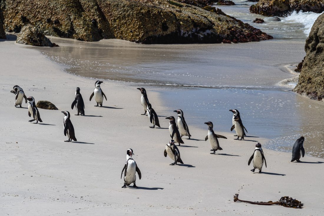
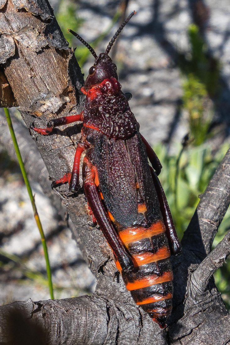
The following morning’s walk, to the small village of Scarborough, was about 15km through another area where we saw very few hikers. It was mostly flat and sandy, with a huge variety of wildflowers and some interesting fauna including the orange and black koppie foam grasshopper and an angulate tortoise. In the afternoon, we had a choice of either a 10-15km off-track hike to the next camp or visiting the penguins at Boulder Beach—we chose the latter!
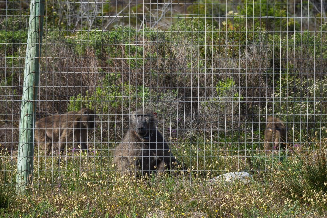
Our final night, which we had to ourselves, was at Smitswinkel Tented Camp just outside of the Cape of Good Hope section of the park. This is the newest of the camps, and the tents even have their own ensuites. However, there is a huge fence around the camp to keep out the chacma baboons. If they manage to get in, they steal food and generally make a mess of the camp, so we had to be very careful to make sure the gates were locked tightly. There was also a couple of park rangers wandering around on the outside trying to shoo them away.
Day 5:
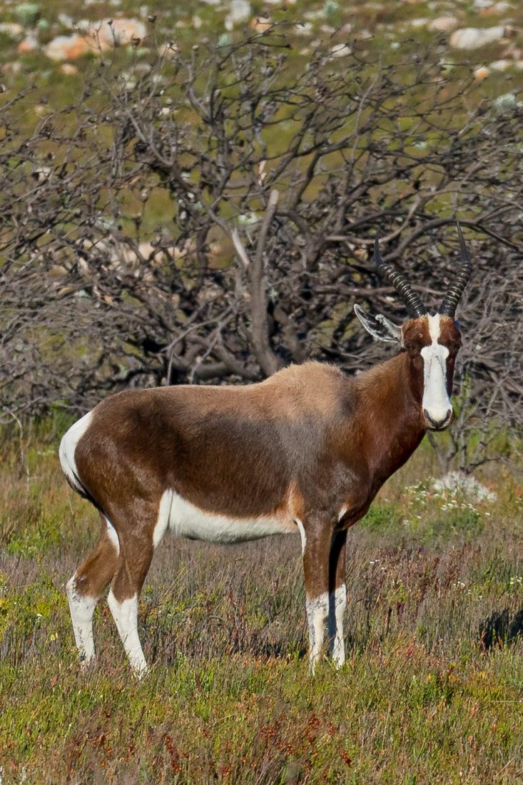
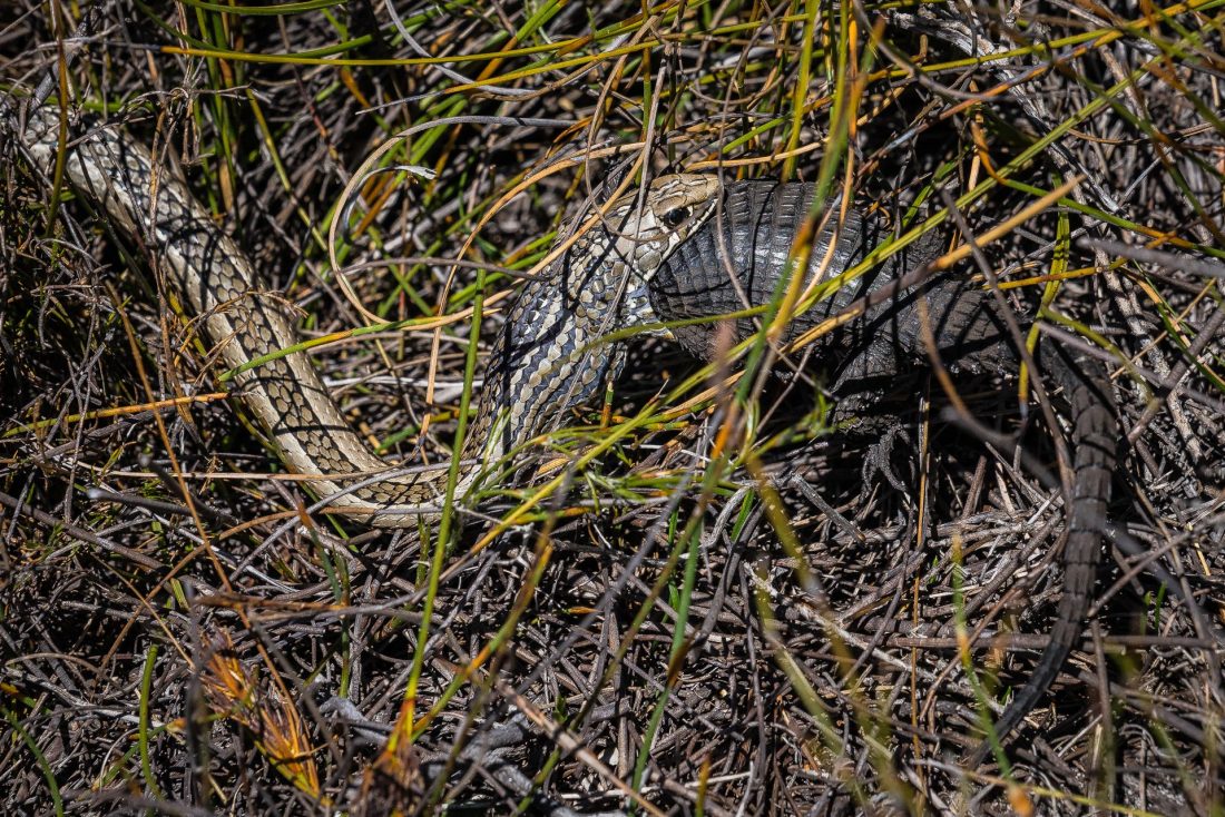
I would not have believed that the scenery could have been any better, but our final day was the most spectacular of the trip. Besides seeing a variety of wildlife—such as rare bonteboks, elands, ostriches, chacma baboons, Cape Mountain zebras and a cross-marked grass snake eating a large Cape girdled lizard—the scenery was amazing. The first section of this day’s 20km walk was following the east coast of the cape, up and down and around the rugged peaks of Judas Peak, De Boer and Paulsberg with views across False Bay and down to Cape Point—our destination. And, of course, we walked through the ever-present flowering fynbos.
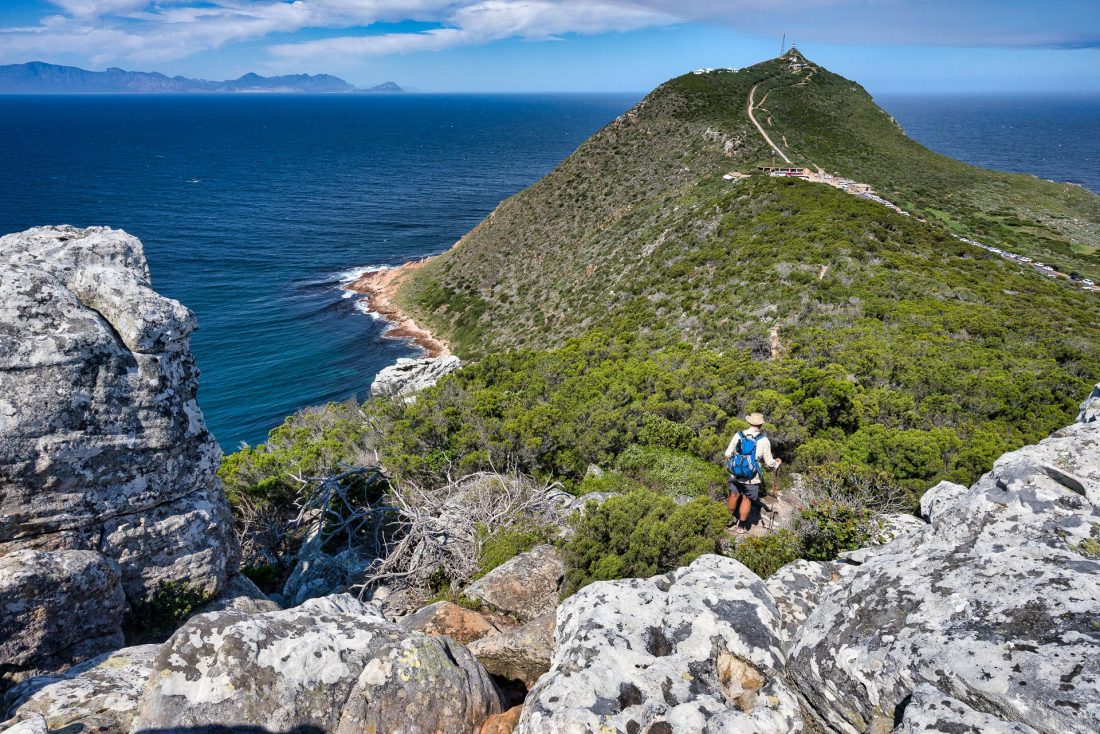
When we finally reached Cape Point, it was a shock to see the hundreds of tourists. However, we continued along the final section to the Cape of Good Hope, where we were picked up to be taken back to civilisation.