The Tyndalls Under Threat
The serenity and ecology of Tasmania’s Tyndall Ranges on the island’s west coast have been threatened by a proposed $40million development for a walking track. Jimmy Cordwell delves into the surprising history of the range, and what’s at stake.
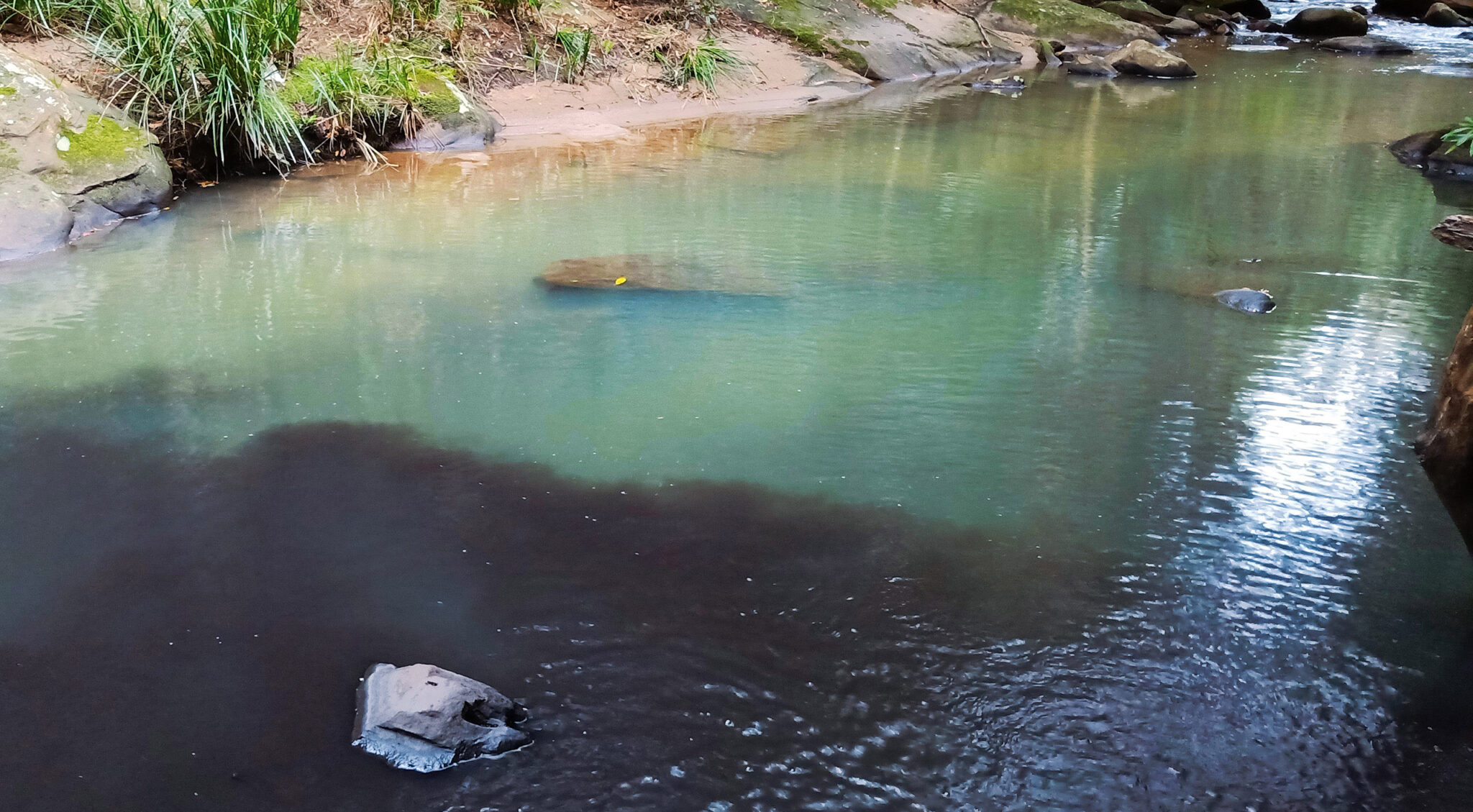
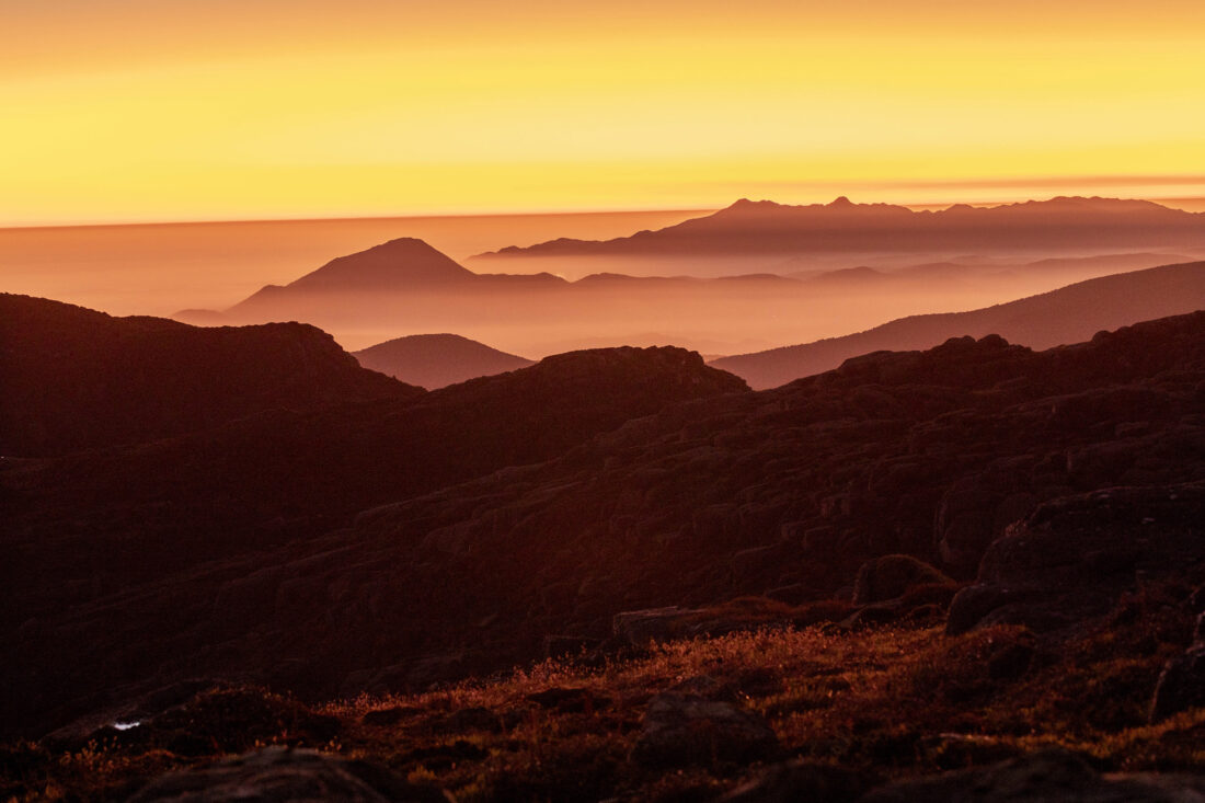
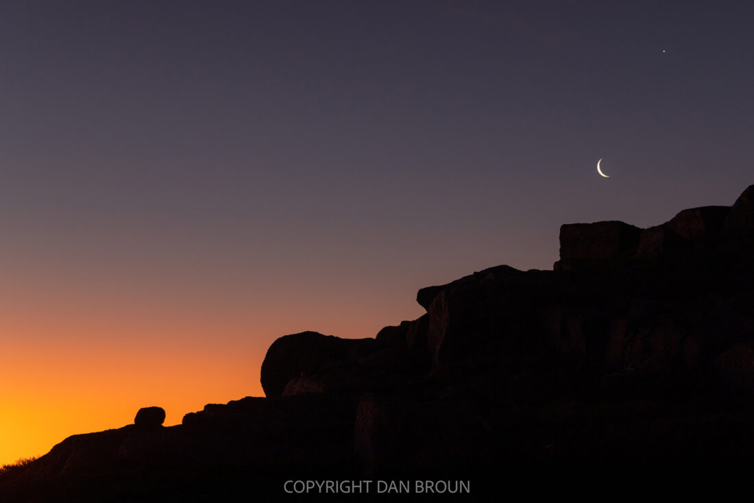
Photo credit: Dan Broun
This past week I’ve been back into the swing of life here at home. The glow of some much-needed annual leave is beginning to fade: Those sounds of kakaruwai (South Island robin) chasing us down the track; the scent of salty air fresh off the Foveaux Strait invigorating our nostrils; my back after a few weeks of sleeping on an inflatable mattress … Aotearoa, how I love you! In returning to my desk, I was welcomed by a reminder that the Tasmanian Government’s ‘develop wilderness’ policy agenda remains of the fullest priority. In this case, their allocation of $40+ million for the proposed development of an ‘iconic’ bushwalk in the Tyndall Ranges. (See: WILD #179 (p26) for further reading on the attempted privatisation and development of Tassie’s wilderness backyard).
Where are the Tyndalls, you may ask?
How much money, you may seek to clarify?
For a bushwalk, you may exclaim…
So, I decided, on this calm and still Friday morning—as scrubtits converse in the melaleuca outside my office and a rouge currawong emerges loudly from the bushline—to delve into this situation in long-form. Grab a cuppa and hit the ‘do not disturb’ button … let’s go to the Tyndalls.
The landscape is Palawa/Pakana Country—has been and always will be. There’s a long history of human life and custodianship along the flanks of the island’s spectacular west coast mountains, stretching tens-of-thousands of years into the past. This piece does draw heavily from the Anglo/Euro names—many of whom never stepped foot on the island—that have been thrust upon Tassie’s peaks, valleys and landmarks. Yet to my surprise, the connection between the west coast landscape and these names, their studies and contribution to science describing local geology actually makes a bit of sense.
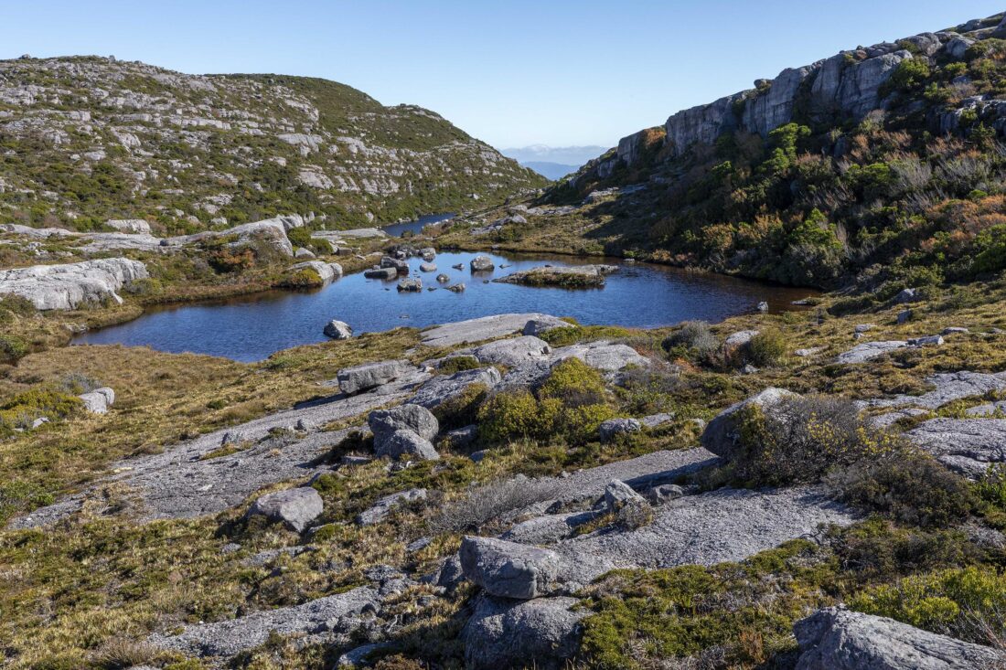
I’ve encountered a couple of ‘Tyndall’ landmarks, both at home and abroad. There are plenty further afield, mostly affixed to valleys, mountains, and glaciers. They are so named after John Tyndall, a geologist from the 19th Century. Tyndall was not just a geologist; he was also a mountaineer and a physicist who notably, as you’ll read later, discovered the greenhouse effect and is often credited with be a co-founder of climate science. Tyndall was particularly fascinated by glaciers, and he explored their function and movement, so calling the range in Tasmania after him is apt—so far as landmark nomenclature goes—given the globally special glacial activity preserved in the Tyndall’s landscape. We’re talking cirques, stoss and lee forms, grooves, striae, lunate fractures … the Ice Aged works. Here, almost two-hundred square kilometres of glacial landform features are nestled into one brilliant patch. The place is chockers with wild character analogous to glacial activity—the shapes and curves that make a geologist’s head spin. The warped foundation of the Tyndalls is spectacular.
Contemporary glacial landscapes are rich in environmental value for a variety of reasons. A simple reason is they’re visually mind-blowing: The weight of all that ice demands solid rock be wrangled into sometimes truly iconic shapes. The top of Mt Tyndall—if you’re able to find the briefest of weather windows and not get blown or washed off the top—features a gorgeous, sloping pathway off into the valley below, with lines still scratched into the rock from the slow, gravitationally challenged ice that graced the surface millions of years ago.
Tyndall was fascinated by glaciers and the responses they had to atmospheric heating, becoming the first to show how atmospheric gases absorb heat differently; that is, gases such as nitrogen, ozone, methane and carbon dioxide were found to each absorb heat in unique ways. As such, his research on gases ‘solidified’ our understanding of what became known as the greenhouse effect—the anthropogenic (or human caused) acceleration of the concentration of certain gases, namely carbon dioxide and methane, which then trap elevated levels of heat and, in turn, warm the atmosphere in unprecedented ways. Contemporary glacial responses to this trapped greenhouse heating are a key example of how the impacts of climate change are felt by a landscape. Glaciers are not thriving in these conditions.
Not too far from Mt Tyndall (around fifteen kilometres to the south) sits Mt Lyell. Named after another geologist, Lyell complemented Tyndall’s work by pioneering the first explanation of climactic change. They researched and articulated the relationship between environment, temperature and precipitation, and how this fluctuates over time. His book Principles of Geology, published in the 1830s, became a foundational text in the discipline. This work has been hugely influential in helping grasp the ‘deep time’ exposed through the geological sciences, guiding the understanding how the globe and its environments changed—and were preserved in the globe’s rocky foundations—over the course of many, many years. (You can read more about John Tyndall here: https://theconversation.com/john-tyndall-the-forgotten-co-founder-of-climate-science-143499)

The research of both Tyndall and Lyell was pivotal to informing our contemporary understanding of modern climate change, an issue which impacts every species, landscape, continent and ocean. This is, of course, principally caused by the unhinged, fossil fuel burning human. Our time of human-led change has been termed ‘the Anthropocene’; meaning ‘human’ (anthro-) and ‘new’ or ‘recent’ (-cene). The same Lyell paved the way for this term, being the first academic noted in seeking to capture the irreversible influence of certain human activity on the ‘deep time’ scale. As a result, he labelled the past ten-odd-thousand years the ‘Recent Age’.
Naming different ages and moments of deep time sits in the realm of geochronometry. Geologists maintain a timescale of major geological activity to describe the different ages of the earth: think baby, toddler, child, teenager, adult but for rocks and over millions or billions of years. You may know of some of these time periods: the Jurassic, the Cretaceous, or even the Cambrian. The Cambrian period was around 480-540 million years ago. It was at this time the super-continent Gondwana started to assemble itself.
Gondwana was composed of the precursors to the southern ‘A’ land masses, with Australia, (South) America, Antarctica, Africa, Aotearoa (and others) fusing together to form a massive terrestrial body covering a fifth of the globe. The volcanic bedrock of the Tyndalls has its origins during this period. The formation of Gondwana altered the globe forever, giving rise to what is termed the ‘Cambrian Explosion’: a time of unprecedented evolutionary progression. Prior to this, single-celled organisms were the norm. But through the Cambrian, the number of multi-celled organisms proliferated, producing a brilliant array of life and the first examples of what we know as modern life.
The term Cambrian was coined by another geologist fella from the same period, named Sedgewick. If you draw a line across the terrain from Mt Tyndall to Mt Lyell, Mt Sedgewick sits right in the middle. The mountain is a geologically fascinating outlier. It’s a far western patch of Jurassic dolerite, a rock of volcanic origins mostly found much further east. Sedgewick himself was a bit of an outlier: He vocally fought the admission of women into Cambridge University. He also opposed the work of Darwin and Wallace, and their paradigm-shifting research on evolution (the not so impressive Mt Darwin sits at the end of the West Coast Range, not too far to the south of the Tyndalls). Sedgewick’s research helped identify the unique evolution boom of the Cambrian, but he attributed this to the creative decisions of a single deity, not the natural selection of evolution. To be fair, his stance was mirrored by many of his contemporaries, including fellow geologist Murchison, the namesake of the heavily glaciated mountain immediately north of Mt Tyndall. Yet this stance in the scientific community—and then much of the broader population—rapidly dwindled. Rapidly for the human timeframe, but at the speed of light compared to the deep time geology their lives revolved around. I guess we all have to pick our battles.
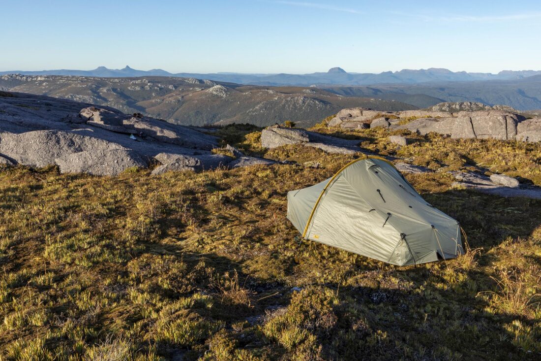
[Authors note on picking battles: some years ago, I slogged across the glaciated terrain towards Mt Sedgewick from the north-east. As each hour dragged on, I seemed to get no closer. It was one of my first solo off-track experiences (I had a PLB and what not), but I was held up by walls of impenetrable vegetation as I clambered over rock ledges and along ancient moraines carved by the flanks of long melted glaciers. Eventually I pulled the pin, retreating to my tent, unsure if I’d ever return.]
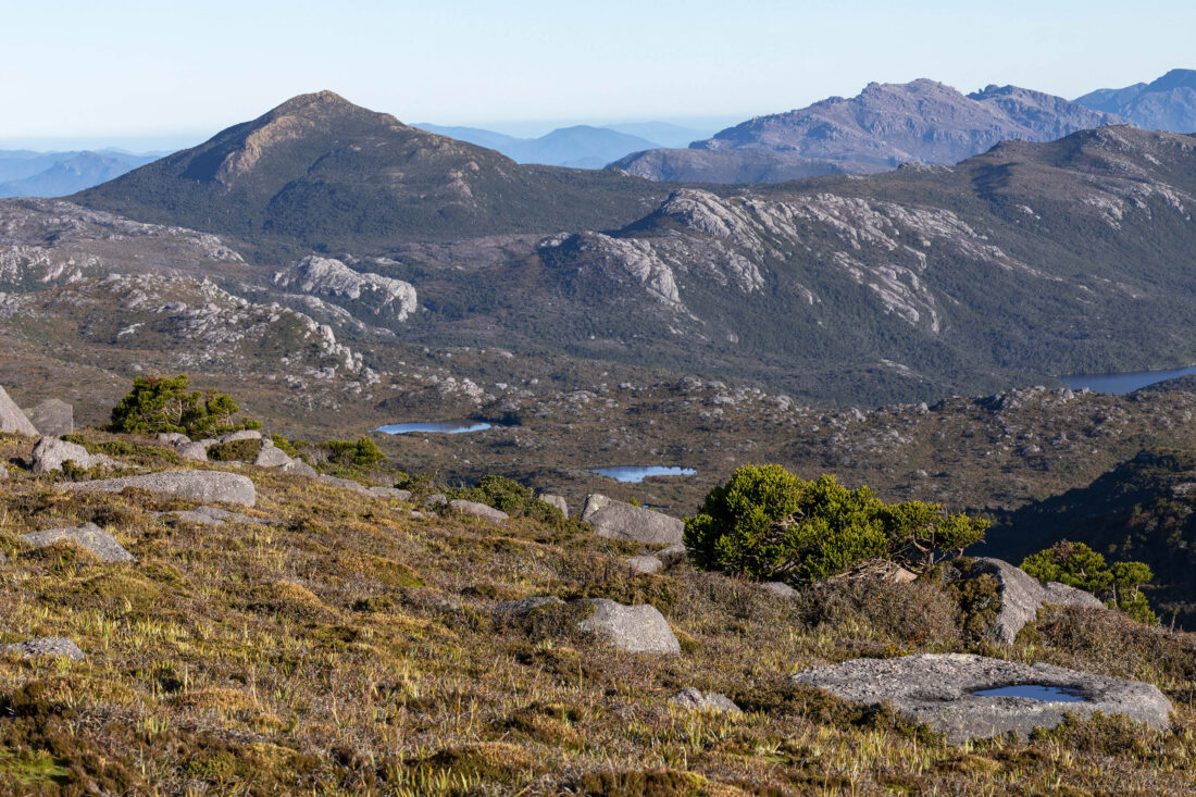
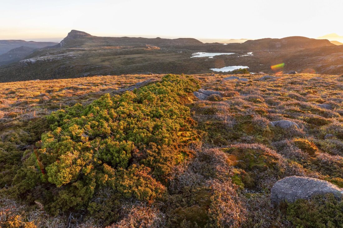
The Cambrian explosion—and the formation of the Gondwanan super-continent—set the stage for the evolution of spectacular organisms. This is on its finest display in Lutruwita/Tasmania, evident in the island’s rich composition of endemic flora. Where once were glaciers, now sits alpine and sub-alpine vegetation. This vegetation—and the number of and variety of certain species—in this part of the West Coast Range is unique, even by Tassie standards. What’s more, virtually all the alpine environs here remain unburnt for millennia. The alpine zone—just like the glaciers which shaped the ground they grow from—are excellent climate change indicators. As the climate warms, the alpine species which thrive in cold, mountainous environments—much like ice—have nowhere cool to go. We’ve seen this through this past summer, and increasingly over past few decades of the Anthropocene. The altered climate is increasingly threatening our connections to half-a-billion years ago.

My morning read into the backgrounds of these handful of 19th century rock-nerds exposes the globally significant natural history embedded into the Tyndalls. Brilliant Cambrian glacial activity which has persisted for eons, preserved in gorgeous stone and cloaked in a dazzling array of flora, gives us a direct link to critical moments of Earth’s history: When Gondwana formed; when ice commanded the land and a young Tassie blossomed; and when multi-celled organisms made their move and permanent mark on the globe. In the not-too-distant past, the Tasmanian Department of Parks, Wildlife and Heritage nominated the Tyndall Range area of the West Coast Range for inclusion in the Tasmanian Wilderness World Heritage Area (See: Appropriate Boundaries of a World Heritage Area in Western Tasmania, p44-46). And for good reason. It’s one of the best examples of its kind. Not just in Tassie, but in the world.
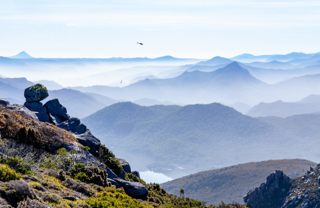
So, here are two points in closing (your cuppa is either well finished or glacial cool by now): One, is this area afforded the recognition and protection it deserves? And two, why, when there’s a wealth of pressing threats to focus on, is the Tasmanian Government forking out $40M+ to build a highly engineered track replete with lodges just so a few people can go a bushwalk in the rain? (Ed’s note: Yes, apparently it rains on average in the Tyndalls in excess of 200 days a year, and it’s one of tassie’s wettest regions, which is saying something.)
Addressing the first of these questions: The Tyndalls are not currently subject to a Tasmanian Parks and Wildlife Service (PWS) management plan, meaning there are no prescribed conditions to be met for any management or development proposal. Further, the proposed development ‘shares’ the land with a handful of mining exploration licences. In fact, if you delve into the project’s feasibility study, and find the section titled ‘Critical Success Factors’ (p.65), under economic factors it reads “the economic potential of neighbouring/nearby areas is not diminished (such as … potential mining exploration to the east of the planned walk.” Iconic. The silver lining of this disastrous, cart-before-the-horse proposal is that the horse—the globally significant, ancient natural values of the Tyndalls—is being given the limelight it deserves to move towards proper protection and management. Fortunately, a little over five kilometres to the east of the Tyndall range, sits the globe’s highest rated World Heritage Area, the Tasmanian Wilderness. What an outstanding coincidence, one which a small boundary re-alignment would rectify.
And now onto the second question posed two paragraphs earlier: consideration of the fiscal priorities for the area. We know the Tyndalls’ development proposal is a captain’s call by department big-shots, not one from the heart of PWS out in the field. Let’s not forget the head of the department who kicked it off is in favour of inappropriate development on public land: “I have absolutely no regrets or anything to hide in terms of supporting the [developers] to deliver the best possible proposal that they can“, referring to support for the highly controversial Halls Island/Lake Malbena development. That proposal was, to put it simply, inconsistent with the world heritage management plan. Again, iconic.
There are a wealth of pressing issues which need proper resourcing. This includes the extensive pre-existing PWS infrastructure around the island. I’ve seen my fair-share of boardwalk that could do with some screws, treefall that could do with a saw, and signage that could do with a lick of paint. But ‘infrastructure begets more infrastructure’, and while it’s estimated this development would cost the PWS around $3M a year to run (that’s a median estimate), this annual cost would be on top of the $40+ million set-up fee. The PWS will be forced to spend crucial time and resources on a superfluous development rather than on pre-existing areas much in need of a little TLC.
Further to this are the worsening threats of climate change and off-tap fire regimes. As Tyndall and Lyell showed, as temperatures rise, evaporation increases and dries out the landscape, exacerbating the likelihood of wildfires. There are thousands of lightning strikes in Lutruwita/Tasmania every summer. Just last weekend I stumbled across a recent lightning strike site in the southwest—the peat was obliterated, radiating out from the impact zone in a fifty-metre radius. Luckily, it was soaked through enough to drench the spark. But the resources required to protect these natural values are going to increase along with temperatures. It needs to, as these are globally significant landscapes. It is of utmost priority that the $40M+ ear-marked for a bushwalk—as well as any other state-government funding of wilderness development coming under the parks-privatisation process—is directed into stronger support for land management in the 21st Century.