

By David Bell
It was one of those days! Those days, when you wonder why you do this bushwalking thing. We’d left the Black River in Victoria’s Gippsland early in the morning knowing that some bad weather was heading our way. The forecast was for several days of high winds and over 100mm of rain so we were glad to get across the river. The weather change hit us as we were about halfway up Mt Shillinglaw. The forecast wasn’t wrong.
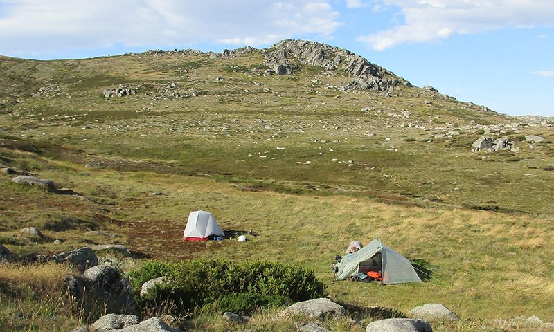
To make it harder, the track was overgrown with lots of fallen timber. Progress slowed as we had to negotiate under and over fallen trees or push through undergrowth. Where was the track! Our aim was to get to Rumpff Saddle, eight days into our walk and where we had a food and water drop stashed nearby. By the time we got to the Saddle we were all completely saturated and grumpy. As we arrived the cloud and mist closed in. But we got the tents up, retrieved the food and water containers and were in a better mood with some hot drinks in us and dry clothes. Our little group of three had been joined by a couple of walkers from Adelaide and a solo Swiss walker. A little tent community waiting out the storm. And there we stayed for two nights until conditions eased. Cheap crime novels were exchanged to fill in the time.
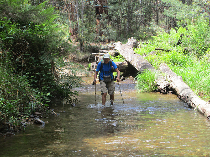
Crossing the Black River
This is how it can be on the Australian Alps Walking Track (or AAWT): a 650km walking track from Walhalla in Gippsland to Tharwa in the ACT.
Bunkered down at Rumpff Saddle
My interest in the AAWT had been sparked by reading an article by Keith Scott in Wild Issue No. 150. He had walked the AAWT from Tharwa to Guthega and I thought ‘I can do something like that!’. I had been looking for an extended walk to do as a circuit breaker after leaving a job which had become unfulfilling and although I had walked parts of the AAWT in Kosciuszko National Park with my bushwalking club, I had never given much thought to the rest of the AAWT.
So in late February 2015 I set off from Thredbo with two walking buddies (Lisa and Mark) from my club, Sydney Bush Walkers (SBW). Our destination was Tharwa, the northern gateway to the AAWT and about 210km away. Twelve days later we reached Tharwa and where my wife, Lucy, was waiting for us with cold drinks and snacks.
Although some of the route had crossed familiar ground, each day revealed something new or unexpected and it heightened how much I enjoy walking through the Snowy Mountains and the adjacent Brindabellas. We tried to include a few side trips and one of the walk highlights was a walk to the summit of Mt Bimberi (1913m) on a sparkling clear morning in early March. We could see Mt Jagungal in one direction and Canberra in the other. The contrails in the sky above also showed why the Sydney-Melbourne route is one of the busiest air corridors in the world.
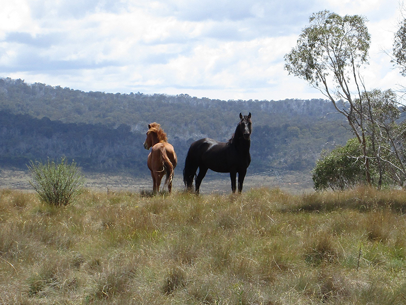
Wild horses are a common sight in Northern Kosciuszko National Park
One of the pleasures of the walk was visiting the old huts along the way. Apart from learning more about the history associated with each hut it was interesting to read the entries in the hut visitor books at the end of a day’s walking. We particularly enjoyed reading the entries of people we knew such as fellow SBW members or people who we had met heading in the opposite direction.
We actually encountered relatively few people along the track, a few walkers and some national parks staff. Indeed some days we saw no one. I was beginning to understand that although the AAWT has been around since the 1980s (and before that when it was the Alpine Walking Track in Victoria), it actually isn’t that popular as a long-distance walk compared to other tracks in Australia.
Once back home someone asked, ‘well that’s fine, but when are you going to do the rest of it?’. Good question, so plans started for the next leg. For no particular reason I settled on the middle section from Mt Hotham to Thredbo. Another 200+ km section.
So in early November 2016, me and three other SBW walking buddies: Anthea, Michelle and Owen set off from Mt Hotham. We were supposed to have a fifth person, but Don injured himself just before the walk started and ruled himself out. But he was there to wave us off.
This trip was organised a bit differently to the first one in that we had stashed some food and water at a place about halfway, near where the AAWT crosses the Benambra-Corryong Road. We were expecting this leg to take a bit longer (fourteen days) compared to the leg from Thredbo to Tharwa.
My reading about the expected terrain and track conditions suggested that this leg would be a step up in terms of difficulty. This would be more of a track walk with less fire trails. There would also be some big steep valleys to cross. I signed up to the Bushwalk Australia forum (www.bushwalk.com) as I was keen to find out about the latest track conditions, in particular the crossing of the Big River. It had been a very wet spring in the Victorian high country and I was concerned about a few water crossings. Posting some questions to the forum demonstrated once again how generous the bushwalking community is with information and knowledge. I have since returned the generosity by posting my own responses to discussions and questions.
There was still snow about the higher peaks when we left Mt Hotham. Our first night was at Dibbens Hut only 8 km from Mt Hotham and well within mobile phone range. So as the outcome of the US Presidential Election gradually unfolded we decided that rather than let the news get us down, we would hereon enjoy the walk and the magnificent scenery. Phones off (except for picking up a weather forecast)!
Indeed the scenery did not let us down and the Bogong High Plains afforded terrific views of mountains such as Bogong and Feathertop.
Snow capped Mount Bogong
Any extended walk needs a Plan B and so it came to pass that with a strong cold front heading our way we decided to abandon our original route to climb Mt Bogong and instead undertake a 50km dash over two days across the Bogong High Plains to a refuge at Mt Wills Hut. We ended up hunkering down there for two nights until the snow showers, high winds and low cloud abated.
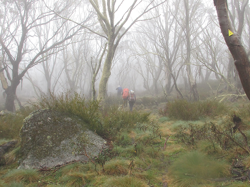
Foggy conditions near Mt Willis
After leaving Mt Wills we descended into the valley of the Mitta Mitta River where awaited our food drop. We donated our empty containers to another walker we had met on the way and proceeded over some days to enter the catchment of the Murray River. We reached the Victorian/NSW border where we enjoyed camping at Wombat Flat, a must visit location along the AAWT. Apart from being able to stand with one leg on either side of the Murray River (the source of the river is nearby), it also contains relics from a RAAF transport plane that crashed here in 1953. Yet another example of the fascinating history of this mountain country.
Packing up at Cascade Hut on the last morning also revealed a Funnel Web Spider lurking between my tent floor and the groundsheet. Pays to check what is underneath before packing gear away.
Back home again and then someone said ‘yeah but what about the most southerly section. This sections makes the rest of the AAWT look easy’.
Other commitments got in the way and I had decided to tackle the remaining section (Walhalla to Mt Hotham) towards the end of 2017. So in late November Anthea, Don and I left Walhalla. It was good that Don could join us after missing out the previous year. As well as using the Bushwalk Australia forum for an update on track conditions, I was also able to tap into the knowledge of Sydney-based walkers who had done this section of the AAWT.
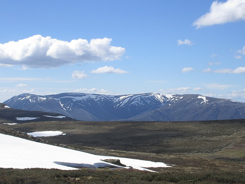
Leaving Walhalla, the AAWT enters Baw Baw National Park and crosses the Baw Baw Plateau before descending to the Thompson River. The Thompson is the first of three rivers to cross in the first week and the valleys here are steep with big descents and ascents. The AAWT doesn’t actually stay much on the Great Dividing Range until you reach Mt Shillinglaw. From here on it becomes a high ridge walk for most of the way to the NSW border.
On the first day we’d been entranced by an echidna which seemed unware of our presence as it ambled down the track towards our lunch spot. Only when it was within a couple of metres of us did it realise its predicament and begin burying itself in the leaf litter.
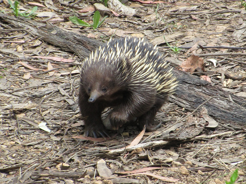
Out for a stroll…
Once the storm had passed we departed Rumpff Saddle, though it was still gloomy with low cloud and mist. The lone Swiss hiker set off at a fast pace and we never saw him again (he was heading to Tharwa). However, occasional footprints from a solo walker over the next week or so were presumed to be his. We kept in contact with the Adelaide couple who were also headed to Tharwa and shared a number of campsites with them.
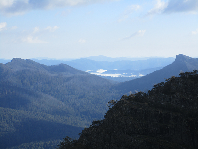
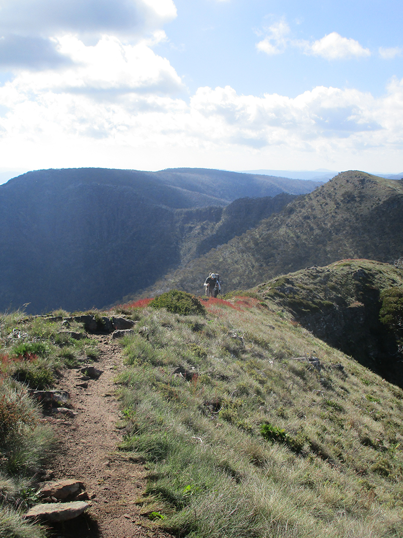
Beyond Rumpff Saddle the scenery also becomes more spectacular and as the weather improved so did the views and there were lots of 360-degree vistas of the Victorian high country. The scenery became really spectacular once we had reached Mt Howitt (1738m) and before us were The Crosscut Saw, The Razor and The Viking. The place names also became evocative of earlier tougher times and we climbed or passed places like Hells Window, Mt Buggery, Horrible Gap and Mt Despair. What could have happened here in the past to leave us with these names?
The Razor and The Viking – Alpine NP
This section also has some of the best walking of the entire AAWT and walking the knife edge ridge of The Crosscut Saw was a highlight (though it would be challenging to do this in high winds). The book on the AAWT by John Chapman and others describes the campsite at Viking Saddle as magnificent and they were not wrong. It’s one of the best campsites I’ve stayed at. It sits at the foot of The Viking cliff line and the late afternoon sun on the cliffs brought out some great colours. It also allowed us time to contemplate the next morning’s ascent of the Chimney.
The Crosscut Saw – Alpine NP
The Chimney is the preferred route up through the cliff line to the top of The Viking (1519m) and has developed a reputation for being a bit tricky to climb. However, the provision of a rope for pack hauling and a climbing rope for walkers has made things easier. Still the presence of a fallen tree at the top of the Chimney has made the climb a little complicated as it narrows the space to negotiate.
It took five of us (the SBW crew plus the Adelaide couple) the best part of an hour to get through the Chimney. One large pack took some pulling and shoving to get around the fallen tree. Being last up I had the advantage of having some willing hands to help get me get up and over the fallen tree. Most of us had some cuts and grazes from the ascent and after some first aid and further mulling over where the track went, we finally descended to the other side of The Viking. And yes, the twin peaks of The Viking and South Viking do look like the horns of a helmet from a distance. Aptly named.
Here the AAWT enters the Barry Mountains which are located in a rain shadow and are commonly known as the ‘Dry Barries’. Water is scarce along this section of the AAWT and walkers need to be aware that water can be hard to find at preferred campsites. However, the wet weather we encountered earlier had the bonus that water was more plentiful (as were the leeches!). Water tanks have been installed in some places and these were all full. However, we weren’t too precious about accepting water from a passing 4WD at our last camp (Murrays Hut Site). By now we were also low on food so dinner for the last night on the track was a triumph of improvisation.
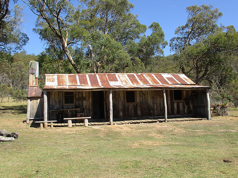
Oldfields Hut – Kosciuszko NP
All in all, a 230 km trip which took just over 18 days. Longer than expected but that’s the way it is on an extended walk. Having now completed all 650 km of the AAWT, I agree that the section from Walhalla to Hotham is the hardest by far. Not just the terrain but there are sections where the track is overgrown, strewn with fallen logs and hard to follow. But the walking is spectacular and it rivals anything else further north.
All in all, walking the AAWT took 44 days including rest days. Nothing compared with the speedsters who have done it in three weeks or less. But doing the AAWT over several years meant experiencing the different seasons and track conditions that a slower pace brings.
Its fair to say that in places the AAWT is a route rather than a formal track, notwithstanding the efforts of parks staff and bushwalking volunteers to keep the track clear of fallen timber and undergrowth. As well, although guide books such as Chapman et al (2009) are essential reading, anyone intending to walk the track must be competent in remote area navigation. This particularly applies in the wilderness areas such as the Razor-Viking, Cobberas, Pilot, Jagungal and Bimberi where track markers are either scarce or non-existent. As well as carrying copies of Chapman’s maps, we carried topographic maps, a GPS and had access to a mapping app on our phones. Even so we still managed to lose the track many times so navigation checks were routine.
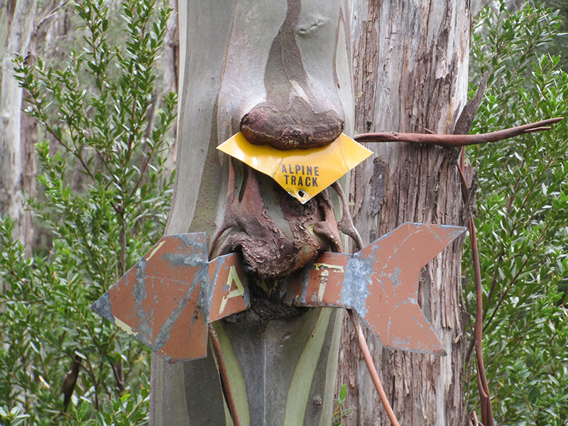
Old track markers
Needless to say, any walking in remote high country will expose you to the vagaries of the weather. It can snow anytime of the year and we got snow showers at Mt Wills in mid-November. So prepare for all seasons and there is no shame in lying low till conditions improve.
So is the AAWT true to its name?
Well mostly. It’s true that there are sections where it avoids the crest of the Great Dividing Range and dives down into steep valleys. In places it also compels walkers to depart from the official route for a more enjoyable walking experience. For example, I don’t know anyone who would willingly take the official route along hard roads from Rawson Pass to Whites River Hut, instead of sticking to the Main Range in Kosciuszko National Park. The only reason to stick to the official route would be if the weather was bad. Some walkers also leave the official route at Schlink Pass to access The Kerries and proceed northwards to Mt Jagungal. This avoids a lot of fire trail walking.
Given the remoteness, the navigation challenges and the varied nature of the track, I don’t think that the AAWT will ever reach the popularity of other long-distance walks in Australia. Its still largely the domain of the independent walker. And I suspect that’s how most of them would like it to stay.
I was also pleased to read in earlier issues of Wild that Geoff Mosley and others are working on a link track from inner Melbourne to the AAWT that would turn it into a 1000km track from Melbourne to Canberra. More strength to their arms to make a ‘sea to snow’ route a reality.
I’ll be back to do that.
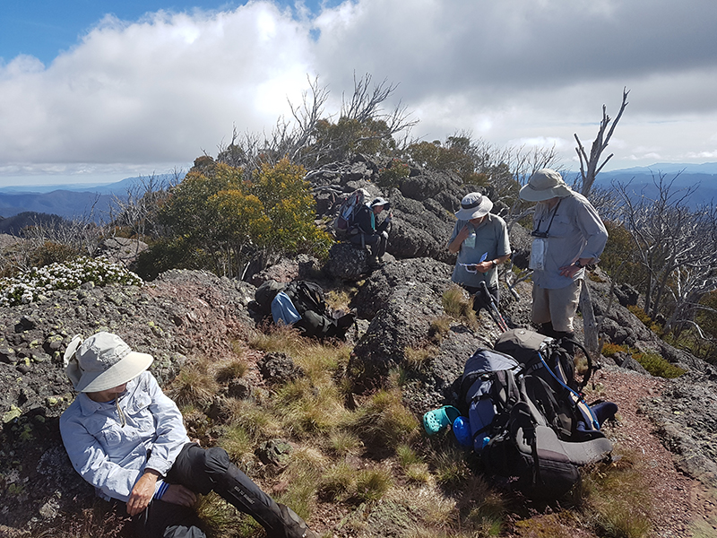
A navigation check near The Viking. Photo: Don Andrews
Book Reference: John Chapman, Monica Chapman and John Siseman 2009 Australian Alps Walking Track Fourth Edition