

“Why don’t you just put it all online?”
It’s one of the common questions we receive at Wild, as many well-meaning readers and contributors wonder how we might improve our digital visibility. Despite the seeming simplicity of the question, the answer is much more complicated and goes far beyond obvious (but nevertheless significant) concerns regarding cost.
Of course, Wild has never had a monopoly on publishing this type of resource and it’s hard to say whether our track notes have ever really been considered a defining feature. Some readers consider them absolutely critical while others are indifferent. Either way there have always been numerous guidebooks and specialty maps available to fill any shortfall in what we provide.
It’s therefore a very natural progression that we’ve seen an increasing number of these sort of resources begin to appear online. Pioneering individuals and organisations, some of them perhaps inspired by the success of Google Maps (as well as frustrated by its lack of detail or relevance for outdoor adventure), have been working hard to overcome challenges that are inherent to this type of online project.
The Trailblazers
Not long ago detailed, interactive walking route maps and notes were hard to come by. There are now many options available.
One prominent example to be found in New South Wales-focused is the Wildwalks website, which is largely the brainchild of bushwalker Matt McClelland (he’s also runs the Bushwalk Australia forum). Wildwalks has recently been updated and includes maps and notes for nearly 1000 routes, which are categorised by length, difficulty and location. The website is limited only by scope, as Wildwalks’ mission is to provide comprehensive information on dedicated walking tracks around Sydney only. As the walks are all generated and vetted by McClelland and his team, this ‘limitation’ is strategic, resulting in great quality information. According to McClelland the Bushwalk.com and Wildwalks.com websites together serve around 5000 users every day.
Looking to Victoria, the two leading websites for walking routes have been created by much larger organisations. Victoria Walks, a non-profit organisation created in partnership with VicHealth, manages a separate website called Walking Maps. This site allows users to share their favourite walks and discover those presented by other users. As such, there are over 1300 walks from across the country available via this website, but this model leaves itself open to inaccuracy and potentially poor quality of information provided.
Great Trails Victoria, an initiative of the state government’s tourism department, offers guides to a select number of tracks for walkers and cyclists (including mountain bike-specific tracks). While users are provided a high level of detail including wheelchair accessibility, elevation and related links, the number of options is really quite narrow.
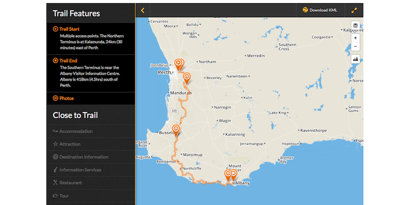
Over in Western Australia there’s a great example in TrailsWA, largely sponsored by the WA government. It’s also charged with assisting the Department of Parks and Wildlife with track maintenance (as yet another sign of the times, TrailsWA notes that it is currently seeking a major partner to ‘assist with’ its track maintenance projects among other tasks).
Elsewhere in the country this kind of information is mostly provided by the government, but there doesn’t appear to be anything as close to the level of sophistication offered by the TrailsWA website (if you know of a website we’ve overlooked, please let us know). The only other alternative worth mentioning is the MapMyWalk website, which is a promotional initiative from Under Armour (the US performance apparel brand). Much like Walking Maps, allows users to upload their own routes and notes to share with others. Unlike similar offerings from the likes of Suunto and Nike, MapMyWalk doesn’t require the user to own the branded technology as a means of buying into the resource.

The Trail Hiking homepage.
Filling the Field
As you can see, the market for interactive track notes is starting to look quite busy, with a wide variety of content styles and business models supporting them. However, that isn’t stopping newcomers from trying their hand at the game.
Like Matt McClelland, Darren Edwards is a regular bushwalker (he prefers the term hiker) who was frustrated at the limited amount of information provided by the majority of websites. Specifically, Edwards was concerned that much of the track information (he uses the term trails) available was crafted for the tourism industry.
Edwards and his partner Julie, who have been recording the details of their walks for some time, decided to launch the website, Trail Hiking. “With our website, hikers can search for trails based on location, hiking grading or distance, or they can simply view an alphabetical listing and map views. Trail Hiking hosts GPX files for all trails so that you can easily navigate the trail and to the trail head itself,” Edwards says.
Whether it’s the quality of information provided on more than 170 walks around the country, the interesting choice of the keywords ‘trail’ and ‘hike’ or (more likely) a combination of both, Edwards says his reach is growing steadily. “Our audience is growing daily and is currently in excess of 6,000 users and close to 30,000 page views on our website each month.” And this growth has led Edwards to making an interesting change in direction.
As a non-profit initiative, Trail Hiking has so far been funded by Edwards and content generated mainly by himself, his wife and a few friends. In order to get more funds and content quickly, the site is now turning to the crowd for support. “We’re now seeking the support of every outdoor adventurer in order to include trails from every state of Australia. We want to encourage them to submit their hikes via our online form,” he explains. “And to further enhance the end user experience, we’re developing a native trail hiking app, complete with trail info, GPS navigation and recoding, compass, weather and so on.” This new project is budgeted to cost in excess of $30,000, which Edwards hopes to crowdfund via Kickstarter.
As a promising new initiative, Trail Hiking can be seen as a welcome addition to a space that seems to be lacking a truly independent, all-encompassing option for walkers who need comprehensive, ad-free information. On the other hand, it’s sheer ambitiousness, the inherent issues regarding crowdsourced funds and content, as well as the many competitors already in the market may well add up to an insurmountable challenge for the fledgling project. But that won’t stop Edwards from trying.
We’re always on the lookout for new and interesting digital concepts that assist people in their outdoor pursuits. Feel free to comment or email us with suggestions of what Wild should report on next.