

Bleached shells, animal bones and stone fragments lay scattered among a windswept coastline. A dynamic, stunning natural landscape whispered the silent wisdom of invisible footprints held by the tide of time.
I had to connect in person to the spirit calling of the Tarkiner Tribe, the traditional owners of the Tarkine Coast for at least 4000 years. From the northwest corner of Tasmania down the west coast to Sandy Cape, I harnessed the wind and the waves to journey by kayak, and explore by foot sandy beaches and sculptured rocky headlands. It was the art of humble beachcombing with empty hands and heartfelt appreciation. I journeyed beside my younger brother Charles, who also paddled a Roscoe Arctic Raider expedition sea kayak.
The sandy-desert landscape of Robbins Passage vanished as a forceful tide engulfed a dramatic transformation and I rubbed my salty eyes with disbelief. An eerie, early-morning fog stood in contrast with a vibrantly streaked eucalyptus trunk scribbled with natural lines that traced the gateway to the past. The Parperloihener band of the North West tribe once knew these sandy tide lines.
My cautious mind lifted with the fog as the swift current, encouraged by the bursting sun, catapulted our kayaks west. Abundant skates waved us on from the sea grass floor as dozens of white-tipped swans observed our enthusiastic antics to avoid the maze of sand bank dead ends to Woolnorth Point. The forceful currents’ united alliance with the southwesterly wind threatened to blow us north off Kangaroo Island into the unprotected waters of Bass Strait. I had no desire for another Bass Strait kayak crossing at that time.
Our tent pitched within metres of the tide line in a small, protected cove of Davidsons Bay, the prospect of the wind-battered islands dotted offshore begged a trip in itself. Larger Hunter Island, Three Hummock Island and more than a dozen smaller rocky features, islets and islands lit up with whitewash explosions.
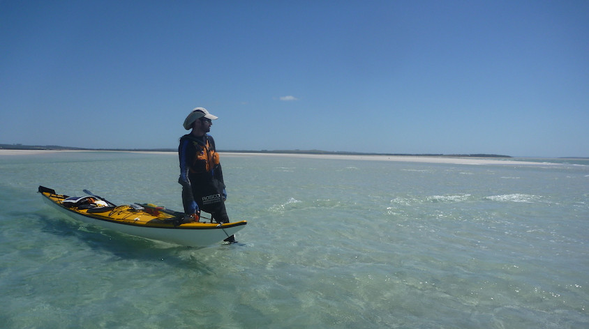
Determined to fish and with the need to avoid the bull kelp surrounding the inner rocks, we swam to the outer rocks. A minute late, a cruising shark prompted consideration of the food chain. I admired the lengths traditional Parperloihener people went to source food.
“Did you pee in your wet suit?” I joked with Charles.
“It was you, wasn’t it?” he laughed.
“You can swim back with the fish!”
Respectfully exploring the tideline to avoid private property, I imagined Flinders’ first reaction as he sailed to confirm the separation of Van Diemen’s Land. He (appropriately) named Cape Grim in 1798 as gale force wind and house-sized giant waves smashed the impenetrable cliffs.
The Woolnorth Peninsula in early European settlement was prominent for pastoral use and lucrative timber production. These were the grounds of conflict between the North West Tribe and the settlers, escalating in 1828 to what has been termed the ‘Cape Grim Massacre’ at ‘Victory Hill’. Varying accounts exist of the retaliation of settlers to the slaughter of sheep Between six and 30 lives were lost.
Offshore sat The Doughboys: literally two 50-metre-high lumps of rock covered in native grass. Seven hectares in size, the mutton birds stamped their nesting claim on this fortress from land predators. The passage offered only partial resistance to the indigenous women of the North West Tribe brave enough to swim to hunt the birds and harvest eggs. It rendered our swim insignificant.
After a predawn trip consideration, the forecasted northwesterly wind swung to settle both my nervous apprehension and the massive pumping swell. The notorious cape distracted from our full appreciation of the excursion as the forceful tailwind, a four-knot tide and the prevailing swell etched another permanent concerned frown line across my brow. The ominous swell exploded on the outer flanks before it rocketed through onto the cliff-lined coastline. The solid four-to-five metre swell bounced back to collide hundreds of metres back out to sea, launching the kayaks on the swell crests as we later disappeared into swallowing troughs.
‘Brace, breathe, paddle!’ My mantra focused as the wind pushed along. My salt-effected eyes stung like raw onion remedy. I now felt initiated to the west coast swell.
Charles and I committed to a nerve-racking 30-kilometre paddle to Marrawah with only a passing glance to Mount Cameron West, also known as Perminghana, with its 2000-year-old carvings.

Remains of an Indigenous midden – an important relic of a culture that existed in the region for many thousands of years.
‘The motifs themselves consist of a variety of geometric or non-figurative forms, such as circles, trellises, and rows of dots. Many of the circles are parts of composite designs, with their interior spaces occupied by crosses, parallel lines or other circles. On a nearby site there were depicted the tracks of a large bird such as an emu. These motifs were made by punching or grinding a series of holes into the surface of the calcerenite and then abrading the ridges between them to form deep incised lines. A few large pointed core tools of hard quartzite and basalt were found in the excavations and these might have been the chisels of the prehistoric sculptors.’*
At Green Point, the southern end of Ann Bay beside the township of Marrawah, even the smallest of the swell at three-to-four metres brought too much risk to both craft and limb. Waves exploded acoustically like dynamite as we snuck between reefs venturing south.
I pulled a bag of nuts and chocolate from my life jacket pocket and practically inhaled it to fuel my fatigued muscles. The break had to be short before the lactic acid in my shoulders hardened to concrete. I watched several surfers catch enormous waves off the headland and realised my hypocrisy when I thought “isn’t it too sharky to be out on the water?”
Large swell persisted at West Point, Nongor to the Peerapper tribe.
‘Semi-sedentary summer “villages” took advantage of the abundant coastal birds and elephant seal colony. Analysis of the faunal remains in these middens revealed young weaning calves were a staple of their diet, before winter months were spent foraging in smaller groups along the coast and venturing to shelter inland.’*
A maze of reefs and exposed rocky platforms forced a chess game. Without warning, periodic large swells sucked up over exposed bull kelp on partially submerged rocks appeared as barrelling curls large enough to drive a truck through. The spectacle was incredible!
The Arthur River mouth, originally home to the Manegin Tribe, is the northern flank of the Arthur Pieman Conservation Area. I strained and pleaded with the rising and dropping swell to leave me high for a second more, to catch more than a fleeting glimpse of the possibility of safe passage to shore. Stubbornly, the ocean toyed with me. The constant, unrelenting sets soldiered in against the river flow and broke across the river mouth. The river spewed tannin-stained freshwater and threw wooden torpedoes – once ancient trees and a prize for craftsmen – in its currents. Driftwood metres deep littered the beach, a warning to my fragile kayak!
The bronze plate at the onshore lookout with the poem written by Brian Indler titled ‘The Edge of the World’ seemed appropriate. The wind dropped as forecasted and further south the offshore reefs offered friendship and safe passage…
…The story continues in Wild issue 151. Subscribe today.